Cerro Azul Meambar National Park

  
The evening rains have begun, pouring down upon a country in true need of the life-giving water. Yesterday, as we drove past sloping fields of corn and sugarcane, Roman told me how dry the spring had been. 

The downpour has gathered us around a simple wooden table, like family united by the bonds of travel. The steady rhythm on the metal roof began gently, but is growing ever stronger, accompanied now by some serious thunder. Safe and dry, we travel with our stories, from continent to continent, and it is amazing to think that this is the life that all the others have been living for months or even years.

Later, while I was writing this, a swarm of brown, lacy-winged insects appeared, driven in perhaps by the solid wall of water. On the rafters above, a gecko is in heaven, feasting, his tongue flicking out again and again amid the bounty. This day has been a good one.

The future of Honduras lies with people like Walter, who used resources like missionaries and a well-known ornithologist living nearby, to learn both birds and English.

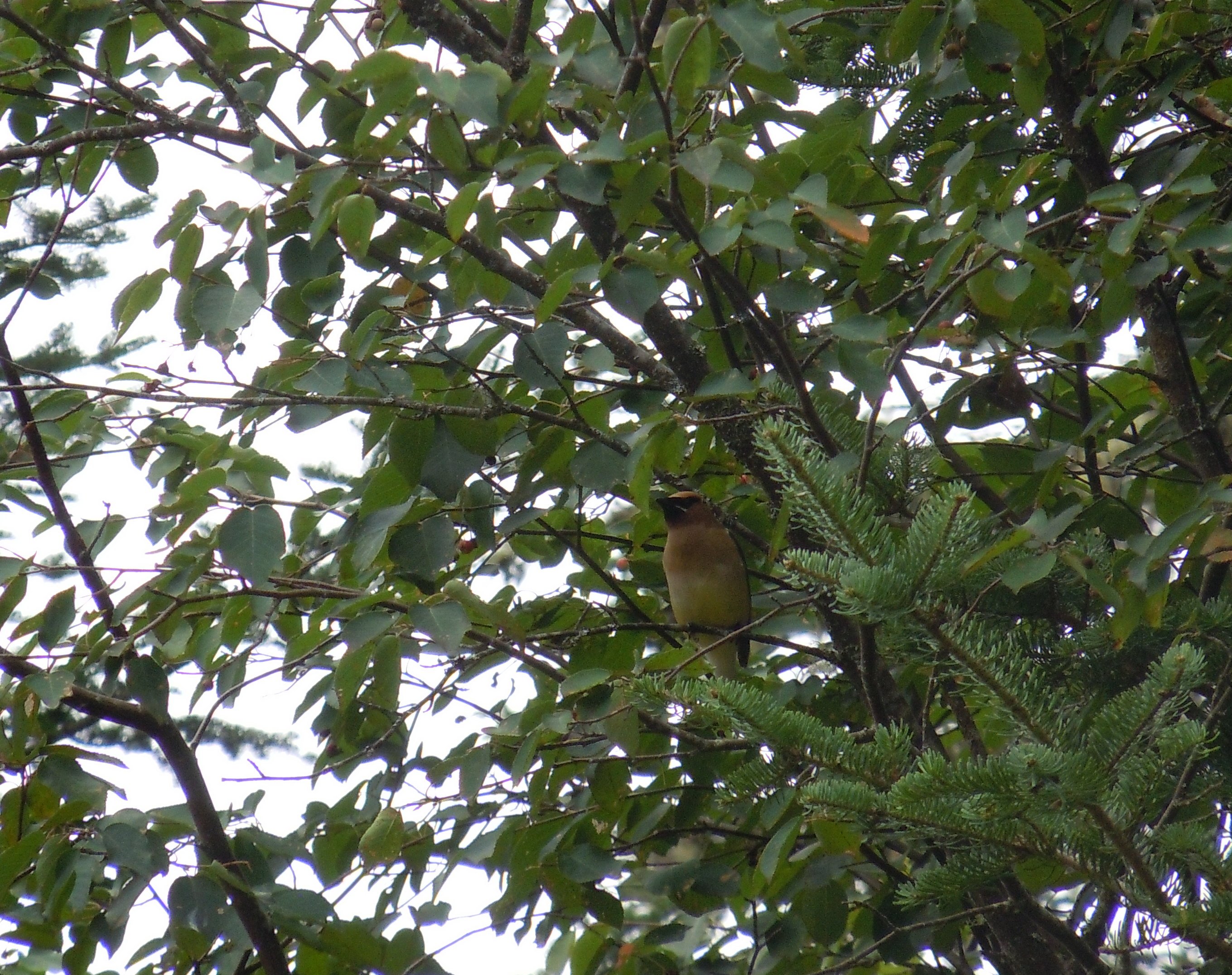
A rustic cemetery, alive with birds, was our first stop. The hour was still early and Walter was quick to call out the species. The golden-fronted woodpecker, crimson-colored and blue-gray tanagers, the Montezuma oropendola, white-collared seedeater, and sulphur-bellied flycatcher. The exotic names and brilliant colors were soon swirling around in my mind as I jotted notes.


When we walked down from the cemetery, we discovered a vehicle full of soldiers waiting for us. They were assigned to protect the national park. Walter assured me that it was the park resources that were in danger, not us. However, one of the soldiers, Luis, walked with us for a couple of hours (with his gun) as we continued upward toward the park. 

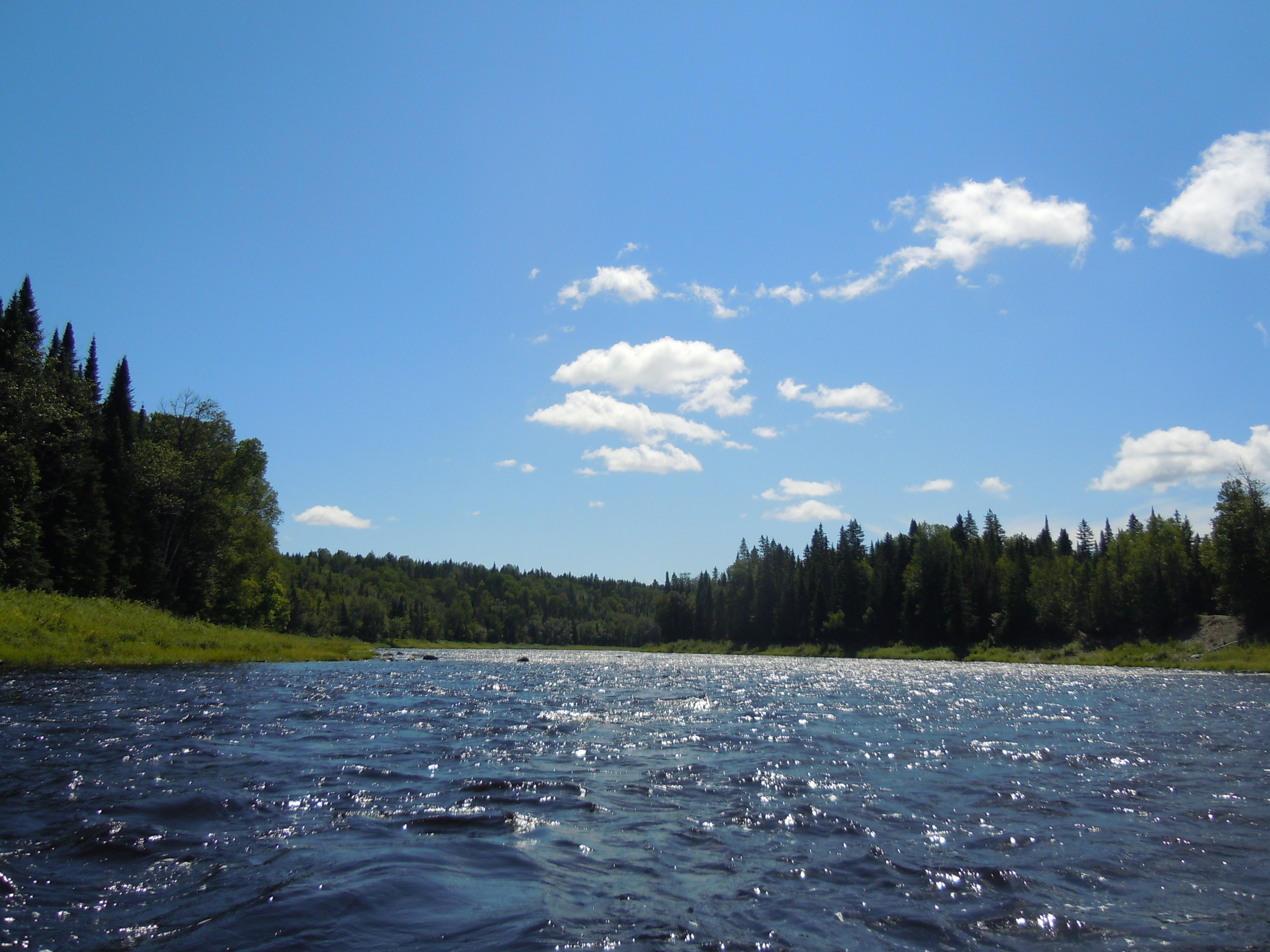
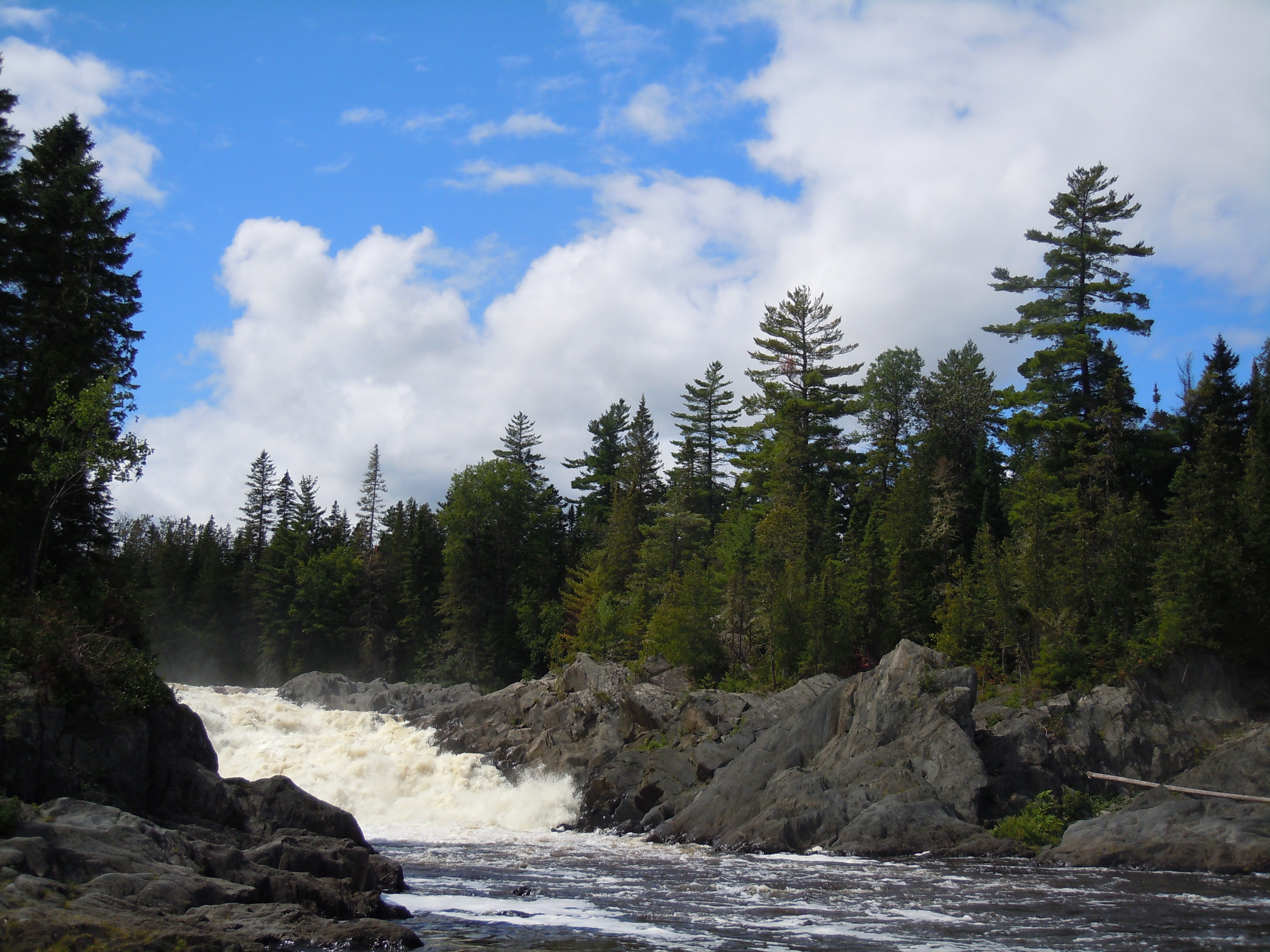
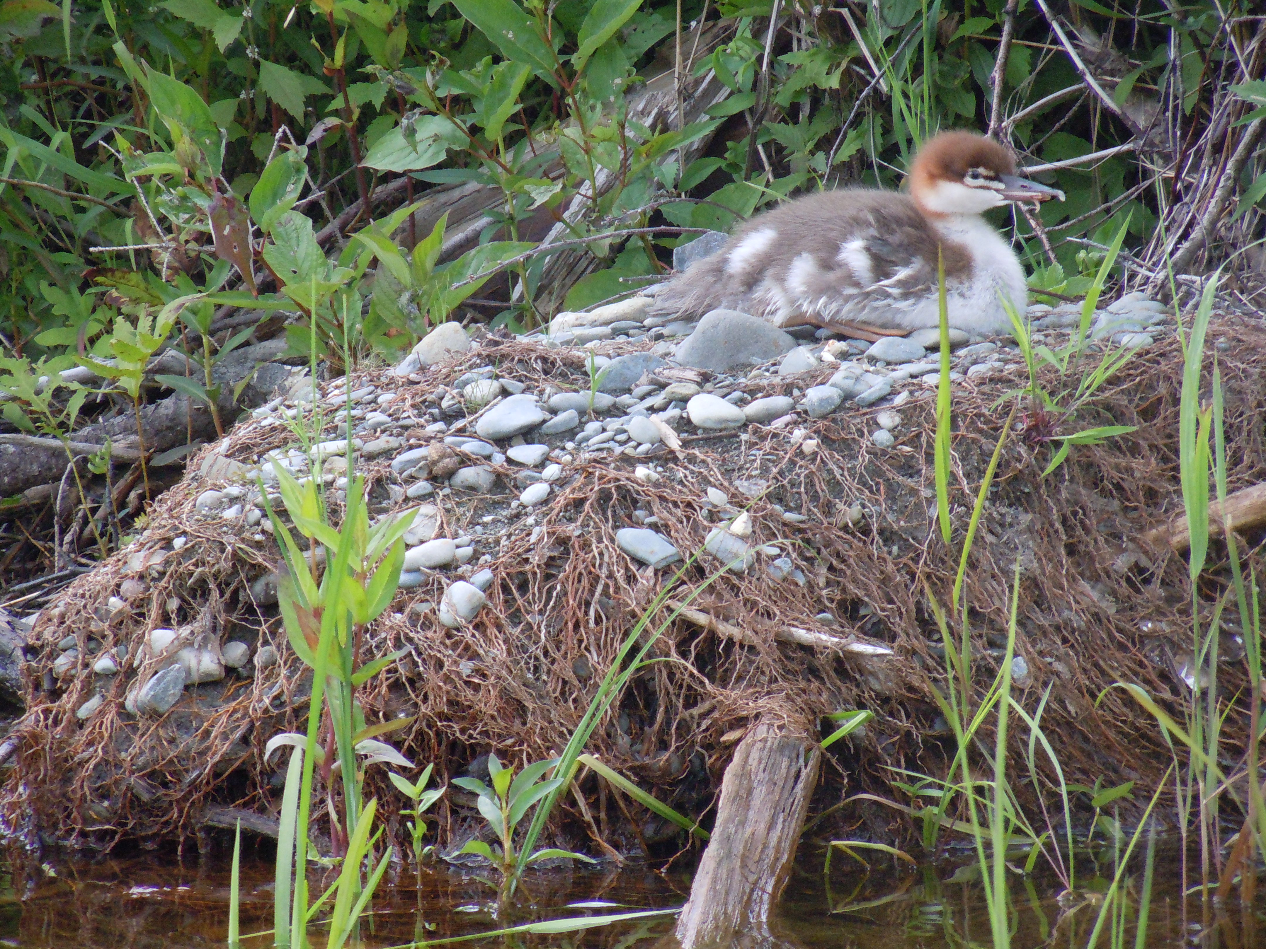
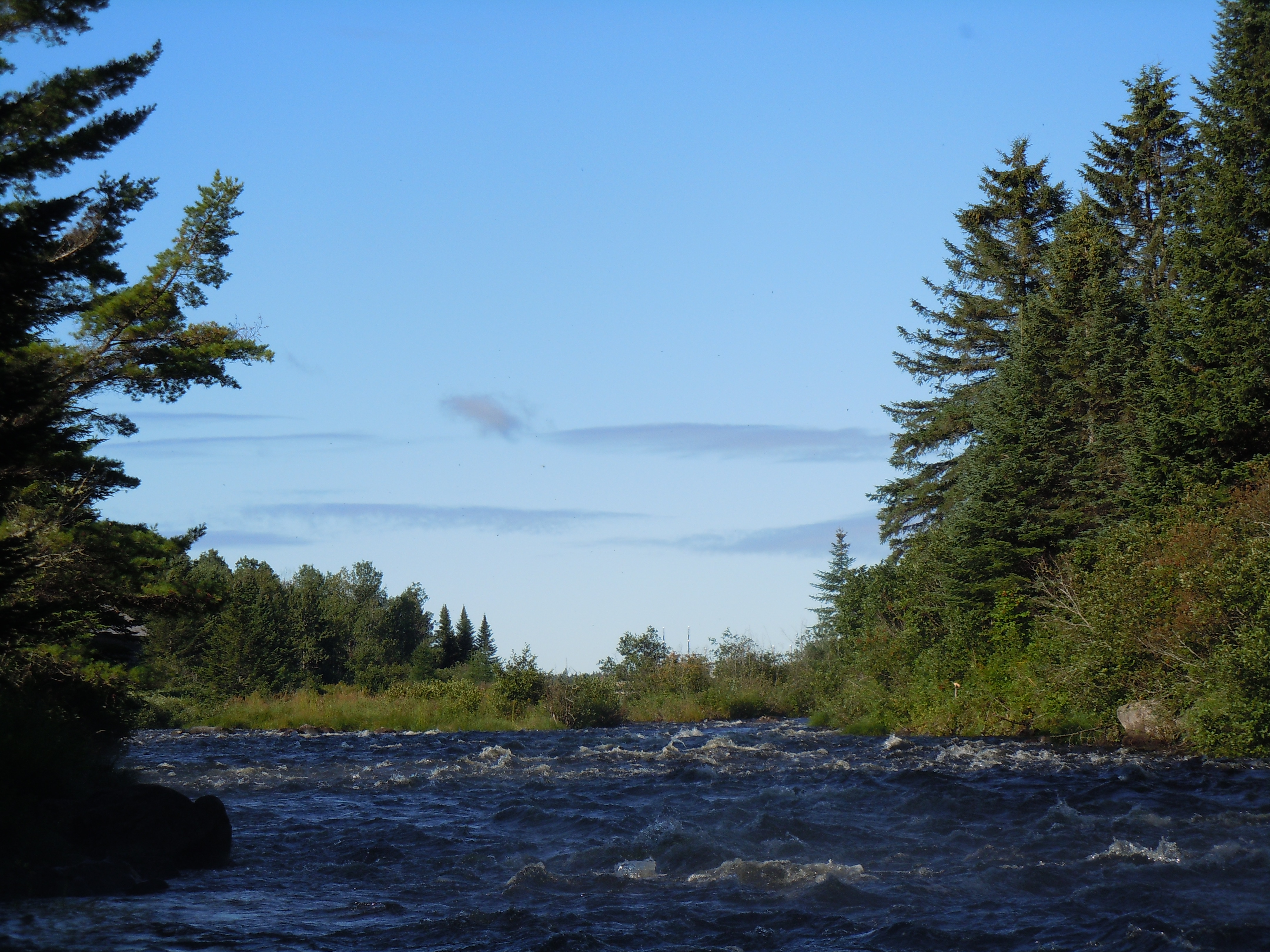
Once inside the park, we were free to roam on our own and quickly found a blue-crowned motmot. Walter was able to set up his spotting scope and I got a good look at this beautiful species, with its long and delicate double tail. PANACAM, as the national park is commonly known, is home to over 250 species of birds, many butterflies, and the waterfall pictured below.Tomorrow I go kayaking on Lago de Yojoa!

A swim under the waterfall brought me back to life after the long, hot walk.


Just beyond my door


Honduras is waking up around me. In the distance is the soft coo of a dove, but most of the voices from the verdant garden are louder, raucous, as full of life as the vibrant flowers that bloom just beyond my door. I was awake this morning while the world still slept, journaling. Bedtime had come early last evening after the day traveling and evening visiting and sampling the microbrews with new friends here at D&D in Los Naranjos.

Yesterday morning we set our alarms for 3 am or 1 am here. My flights were both on time, efficiently depositing me (and a plane full of mission teams in their matching colored shirts) at the San Pedro Sula airport in record time. Roman was there to meet me, holding a neatly printed “Laurie Chandler” sign, a shout of welcome in the steamy bustle.


Must say farewell for now because Walter the guide and I are going birding and hiking in Cerro Azul Meambar National Park in a little while. First, though, some local coffee, fruit, and granola!

Messing Around in Boats

Believe me, my young friend, there is nothing – absolutely nothing – half so much worth doing as simply messing around in boats.

Kenneth Grahame, The Wind in the Willows

If there’s a special young person in your life, between the ages of 10 and 14, please consider the NFCT’s Nothern Forest Explorers Program for them this summer. Five days of wilderness paddling under the expert care of a registered guide and accompanied by an environmental educator interning with the NFCT. The cost is fair at $500 for 5 days; some scholarships are also available. No paddling experience is necessary.

Click the Northern Forest Explorers link for additional information and to apply. Down below the photo are quick descriptions of the trips.

170 - Rips
Wilderness paddling gets in your soul and brings you back to the river, creating memories like this day on the Allagash with my father and my son Taylor, who took his first wilderness trip at age 7.

Currently, there are openings on all five of the Maine trips, including the 34-mile Moose River Bow Trip near Jackman, which was my first solo wilderness paddling adventure back in 2010. Here are all five options, the third and fourth only open to Maine residents:

July 5-8 – The Moose River Bow Loop Trip led by Adventure Bound

July 18–22 – Western Maine’s Mountains, based on Flagstaff Lake and led by Adventure Bound

August 1–5 – Thoreau’s Maine, led by The Maine Winter Sports Center, paddling the waters of Thoreau’s journeys in The Maine Woods. 

August 8–12 – Maine’s Wild Allagash, led by The Maine Winter Sports Center, paddling the Allagash Wilderness Waterway from Umsaskis Lake to Twin Brook.

August 8–12 – Richardson Lake Explorers, led by ELC Outdoors and expanded to include an adventure ropes course and whitewater rafting, based on the Richardson Lakes.

If I was 10 to 14, there’s nothing I’d rather do this summer!

Tradition Meets Innovation at the Maine Canoe Symposium

For weeks I’ve been feeling the pull to return to blogging. Writing has been consuming my creative energy as I continue to work on the book about my NFCT thru-paddle, but I miss blogging. So hello!


Setting up camp in a circle of friends

My summer adventures began at last weekend’s Maine Canoe Symposium, reconnecting with friends, sharing NFCT news, and pushing my comfort zone.

It was equally challenging to learn paddleboarding from Moe Auger on windy Moose Pond and to build a reflector oven under Nicole Grohoski’s encouraging tutelage. After journeying so many miles last summer, Geoff Burke’s workshop on double-bladed paddling added new insights and fired my desire to switch to a longer 8′ 3″ handcrafted Geoff Burke paddle someday!

There’s a problem with the MCS workshops, though. One weekend just isn’t long enough to attend all the tantalizing choices. I missed the chat with Gil Gilpatrick and hearing about paddling Ontario. Oh well, there’s always next year and I did get to talk with Gil about book publishing, which is close to my heart right now. More on that soon.

Beth and Kathy built reflector ovens with me, as did the Flint family. Someone said we should have a bakeoff next year!


A new dragonfly meets the world


Putting the word out

  
Today at church, Arne Aho asked me if there would be more blog posts.  The answer is definitely yes.  

The weeks of being back home have been full.  Since finishing the “missing chapters,” I’ve started scribbling thoughts for the book.  Family visits, house painting, walking and paddling, and a happy start to the school year have filled my days. 

I thought you would like seeing two newspaper articles that have been published.  The recognition is fun, but also very humbling.  Both included many photos, which tell the story well.  Hope the links (in blue) work! 

Deirdre Fleming, a staff writer for the Portland newspaper, tried hard to meet me on the NFCT.  She and a photographer had hoped to camp and paddle with me.  Alas, we couldn’t connect on the trail, but last Monday she came to Bremen.

Deidre brought her canoe and we went out on McCurdy Pond, from Ed and Carol Knapp’s cottage.  Today’s article in the Maine Sunday Telegram captures the essence of our conversation and promotes the NFCT well.
 

Paula Roberts wrote a front page  article in The Lincoln County News soon after I got home.  She spent a lot of time with me, covered a generous amount of material and included some of my favorite photos in color in the Aug. 27 edition.

Thanks to both writers for their interest in my story and efforts to raise awareness of the Northern Forest Canoe Trail!

Day 53: Allagash Village to the Eastern Terminus of the NFCT (30.8 miles)

Sue Kelly and I in Two Rivers Lunch, surrounded by the authentic charm of the northwoods of Maine.

Dad capsized.  I dropped our camera in the water.  Not a promising start for a 27-mile day.

After a hearty breakfast, we started off at 8:45 a.m. with less than a mile of the Allagash remaining before the St. John.  In this short section lies fairly straightforward Casey Rapids.

Dad suggested I go first today, to find a good line through the whitewater sections.  I had just swiveled around to check on Dad when he tried to navigate between two rocks and hung up on a third, tipping over and going for a chilly swim.  I scooped up his floating hat and water bottle, as he walked his canoe to shore, still with a solid grip on his double-bladed paddle.  In my helpful fashion, I hauled his boat up on shore and dumped out the water.  It was a day later (on the way home) before he realized that was probably where he lost his GPS, rather than in the river itself!

Turning downstream on the St. John, we searched carefully for the last two missing items…Dad’s spare custom cherry canoe paddle and his bleach-jug bailer.  You will be happy to know that although Dad spotted just one of them, it was the paddle.  Where Pelletier Brook enters on river right is a Class II rapid not marked on Map 13, which I successfully ran right down the center.  Dad was nearer shore and was forced to line his boat along the edge.  Trying to take his photo with one hand and bring him a makeshift walking stick in the other, I dropped the camera, so no action shots today.  From here our luck had nowhere to go but up.

Mom has gotten comfortable driving Dad’s Toyota Tacoma truck just for this trip (thanks, Mom!) and she met us in St. Francis for lunch.  In spite of the challenging morning, we decided to continue on after our lunch of cheeseburgers, soda, and candy bars from the general store.  Norm Pelletier, who generously let us access the river through his campground, estimated that we had 4 1/2 hours to go to reach Fort Kent.  As much as I had wanted to dawdle on the Allagash, I wanted to hurry now.  It was starting to rain in earnest, but the four difficult Class II rapids were all behind us.  Dad had run the last several perfectly, including the huge standing waves in Rankin Rapids.  So off we went in the fast-moving current, averaging about 4 mph.

After pausing in the river while Dad went shivering up to fetch his phone, I paddled the short distance that remained. Just before 6 in the evening, I stood at the kiosk marking the Eastern Terminus of the NFCT. I was finished.
We forgot to take Dad’s photo until the next morning as we headed for home. Dad has now paddled Maps 1, 2, part of 10, 11, 12, and 13.

TOTAL MILES: 749.7  (the official NFCT literature gives the total trail distance as 740 miles)


Day 52: Big Brook South on the Allagash River to Allagash Village (9.8 miles)

I woke to crisp air and ate the last pack of Quaker cranberry walnut protein oatmeal, a delicious choice that I didn’t tire of all trip.  I stayed late in camp again, photographing more mushrooms and drying all my gear thoroughly, as tonight would be a cabin night.

DSCN8587

I had forgotten how beautiful the last miles of the Allagash Wilderness Waterway were, with tall conifers as a backdrop for green grassy banks.  I felt the sadness of ten years ago, treasuring every mile, knowing that next summer’s plans may not bring me to the Allagash at all.  The thought of the meal awaiting me at Two Rivers Lunch did cheer me up a little and kept me from just stopping altogether.  This section includes some Class II rapids, both those at Twin Brooks (marked on the map) and another set midway between McGargle Rocks and Ghost Landing Bar.  These names are haunting, as both stem from logging fatalities of a bygone era.

DSCN8594
I was worried I would end with 13 moose for the trip, but just past the sign announcing the end of the Allagash Wilderness Waterway, I spotted a young bull, tallied as Moose #14.
DSCN8601
Two Rivers Lunch in Allagash Village is always a most welcome sight after days on the river. Waiting for Mom and Dad, I had plenty of time for a salad, cheeseburger, fries, and ice cream.

Tonight we would be staying right here, behind the restaurant, in one of the cabins owned by Tylor Kelly’s Camps.  In 2011, when I arrived in Allagash Village with Dad and Taylor during Paddle for Hope, Sue Kelly gave us the warmest welcome imaginable.  She baked us brownies, brought us shampoo and half and half and let me use her computer for hours (not to mention donating to our fundraising for the Maine Children’s Cancer Program)!   We had made a friend, and have since come to know the rest of her friendly family.  So tonight felt like home, especially after Mom and Dad drove in with pork chops to cook for dinner.  Tomorrow Dad will rejoin me to paddle the St. John River, perhaps in one marathon day to Fort Kent.  We’ll see!

TOTAL MILES: 718.9

Day 51: Deadwater North to Big Brook South on the Allagash River (12.0 miles)

DSCN8505cropped

Today is Sunday, a day of rest, and a quiet morning in camp gave me time for thanksgiving and awe at the fact that I have safely journeyed so many miles.  A “good morning” from the garter snake (or is it a milk snake?), the warmth of a campfire, three cedar waxwings in the cherry tree, journaling…and a visit from ranger Matthew Jackson, who came up to chat after learning that I was doing the NFCT.  His family is from the village of Allagash and he has recently moved home to the family’s farm at the site of Dickey Plantation, the home of one of the area’s early settlers.  (Kathy, it won’t be difficult to remember his name, will it?).

DSCN8508
Matthew, headed over to Deadwater South, where he is working on creating more level tent sites for future campers.

PADDLER’S NOTE:  The river flow was still very high for August, measuring 1,900 cfs as reported on the bulletin board at Michaud Farm, where all paddlers officially check out of the Allagash Wilderness Waterway (although the AWW continues to Twin Brooks).  I saw many groups between Eagle Lake and Churchill Dam, but then must have gotten ahead of the crowd.

DSCN8521
My faithful boat awaits its last portage, fittingly a carry around Allagash Falls.
DSCN8528
Today I went into a flurry of mushroom photography…this is my favorite!
DSCN8538
The clouds broke while I ate a quick peanut butter and jelly wrap at Allagash Falls. Today, incredibly, my mileage total passed 700 and the ease of this portage confirmed my current level of fitness.
DSCN8548cropped
My evening campsite came with a lovely pile of split kindling, a joy to behold.
DSCN8552
Yesterday I camped at an old favorite, today I discovered a new one, Big Brook South, an open, sunny space with a commanding view of the river (although access is up a steep and challenging bank).
DSCN8555
This is profound…tonight was my last evening of wilderness solitude. One by one, the stars emerged, as I wrote deeper and deeper thoughts by the light of the campfire, never wanting this time to end.

TOTAL MILES: 709.1

Day 50: Sams on Long Lake to Deadwater North on the Allagash River (27.0 miles)

Last summer, Dad, our friend Mike, and I shared a magical campsite abounding in wildlife and blueberries, called Deadwater North.  Today’s goal was a long day of paddling (23 miles was the projected distance in my notes) to return there, although I knew that this year there would be no bacon and blueberry pancakes or baking in Dad’s reflector oven.  Anyway, it was disheartening to start out into a hefty wind right in my face, one that also seemed to keep all the wildlife from the water.  The pull of the current was a welcome ally as I returned to the river after several miles of slow going.  At Long Lake Dam, perhaps in memory of Chris, I decided to line the boat through on river left, as we did in 2005, rather than portaging on river right.

Lazily, I did not even attach a stern line, and was lucky that I didn’t end up swamping the boat.  With the present high water levels, I could actually work it along most of the shore in very shallow water, where the metal spikes remaining from the original dam could easily be avoided.  When I reached the last swift drop, though, the safe, shallow edge evaporated, the river snatched at the boat, and it was almost a disaster.  For a moment, the canoe tipped and took on some water and it took all my strength to wrestle it back under control and maneuver it into the calm pool beyond.  All’s well that ends well, but next time I would definitely attach a second line!

DSCN8423
The site of former Long Lake Dam, where I lined my canoe through along this shore.
DSCN8442
The first of the landmark elms that greet paddlers as they approach Round Pond. These trees survived Dutch Elm Disease due to their isolation in the Allagash wilderness.
DSCN8444
I had one quick chance at this photo as I drifted by, at first thinking this was a merganser nest, but I don’t think it is.
DSCN8447
Today’s flower of the day, quite common in the delta approaching Round Pond.

As I entered Round Pond, a squall blew through.  First, a dark gray cloud inevitably overtook the sky, before reaching a point where the cloud simply enveloped my whole world.  Rain pounded the lake and I paddled furiously in an effort to stay warm, passing a family huddled under a tarp at the Inlet campsite.  As usual, I was in my bathing suit and a thin t-shirt and shorts, and probably looked crazy.  At the ranger station, I stopped to bail out the boat and Kale invited me in where it was somewhat warmer, especially after I put on a dry thermal top.  I recognized him from last summer at Michaud Farm and we chatted about float planes and bears and the hit that the moose population has taken this year.

Kale explained that a species of tick which had never successfully overwintered this far north has now gained a permanent foothold.  The ticks are drawing so much blood that moose are becoming anemic, and dying, or, if they survive that, then scratching themselves bare in large patches, and freezing to death during the harsh winter.  After that conversation, I felt quite lucky to see three moose after the weather cleared, a bull and two cows.

DSCN8458
This will get your adrenalin going and keep you paddling a few more miles!
DSCN8471cropped
This mighty, magnificent monarch of the river seemed comfortable with my presence as long as I didn’t get too close.
DSCN8494
A rainbow sky across from Deadwater North as I finished my 27-mile paddling marathon
DSCN8497
Mike and Dad, look who’s living among the fireplace rocks at our campsite.

For supper, I tried herbed mushroom risotto with basil pesto, a gourmet dehydrated meal from a new company called Good To-Go in Kittery, Maine.  The company’s meals were recommended to me in the camping department at Maine Sport and this first taste of their food was delicious, with a fresh, colorful appearance and a list of ingredients that were all easy to pronounce (as the package points out).  Not bad when there is no reflector oven in sight!

TOTAL MILES: 697.1

Day 49: Jaws on Churchill Lake to Sams on Long Lake (17.3 miles)

Today…the story in photos…

DSCN8343cropped
Still thinking about that cornbread. Heidi promised to send me the recipe, which came from a famous chef in New Orleans. She came down this morning to watch me go and spotted a moose.
DSCN8349
All poised to run Chase Rapids, with my gear, feeling butterflies. I decided not to use the gear shuttle service. Josh, the ranger, released 1,000 cfs from the dam this morning, to bring the river to 2,000 cfs.
DSCN8354
Looking back at the first rapids. I bailed five gallons of water from my boat after the first two, due to the size of the standing waves. From my journal: “My boat is forgiving and tough and brought me through quite confidently.”

PADDLER’S NOTE: The Saranac River in flood stage was much more powerful and the rapids on the Moose River trickier with less water than Chase Rapids.  I was glad I decided to keep my gear, which gave my boat the same feel that it has had for hundreds of miles.  The first mile of Chase Rapids has all of the Class II rapids, with a chance to catch your breath between each.

DSCN8372
Bank after bank of Joe Pye Weed lined the shores.
DSCN8374
Look who I met! NFCT interns Jared and Paul on their last day of work, finishing a stone staircase at Meadows. Paul spotted a moose and, earlier, I had seen a mother and calf on Heron Lake. My count is now 9 and theirs 45!
DSCN8387
Umsaskis Lake in a time of afternoon stillness. God’s presence seemed to abide here, surrounding me with peace. Uncannily, ten years ago this day was my first on the Allagash, as Chris brought me here for our honeymoon.
DSCN8393
Almost forgot my end-of-map photo, but the American Realty Road bridge was still in sight behind me.
DSCN8404crop
Finally, a great blue heron poses, abandoning their usual shyness.
DSCN8410
Last moose of a moosey day…this cow didn’t even know I was there as I observed her feeding for a long time. I thought how content she must be – mostly underwater, away from the bugs, and indulging her enormous appetite for tasty aquatic plants. The tan sandy bank on the far shore is typical of the appearance of a campsite from afar.
DSCN8411
This is that moose, shaking herself just like a dog!

What an awesome day, what an awesome place, the icing on the cake of this incredible journey!

TOTAL MILES: 670.1