Day 32: Haines Landing, Oquossoc to the Maine Forestry Museum, Rangeley and the Hartman’s cabin again (10.1 miles)

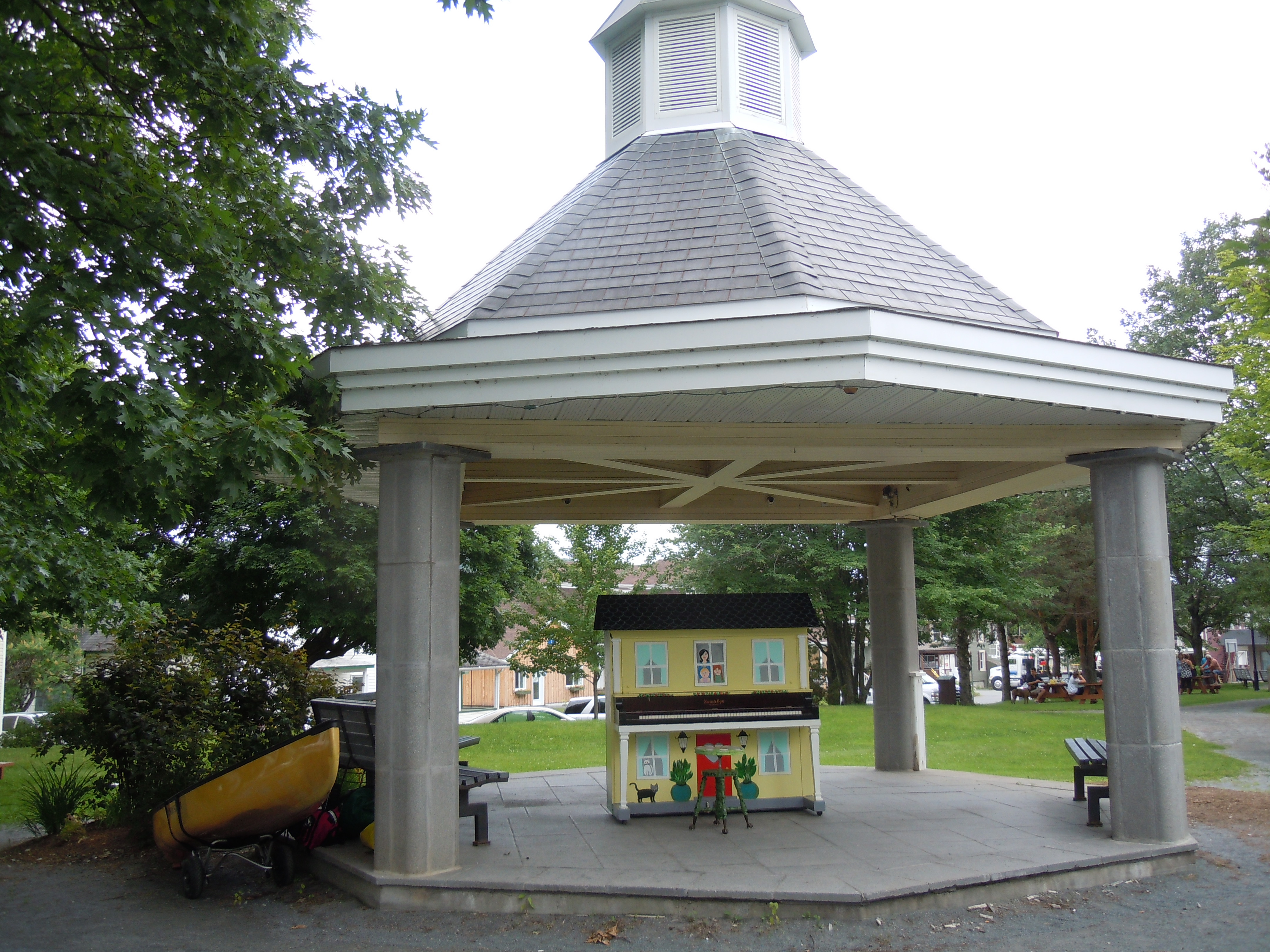
Another great Cup o’ Tea tradition is signing the wooden steps, which still bear the marks of Paul’s father’s measurements during construction.  I added this year’s adventure under my 2011 Paddle for Hope signature.


Paul served omelettes made to order, mine with cheese, tomato, and pepper, along with toast and raspberry jam that Janie had made from local berries…yummy!  We ate on the porch, the lake a mirror, while fog still hovered on the mountains.  

I could happily live on this porch!

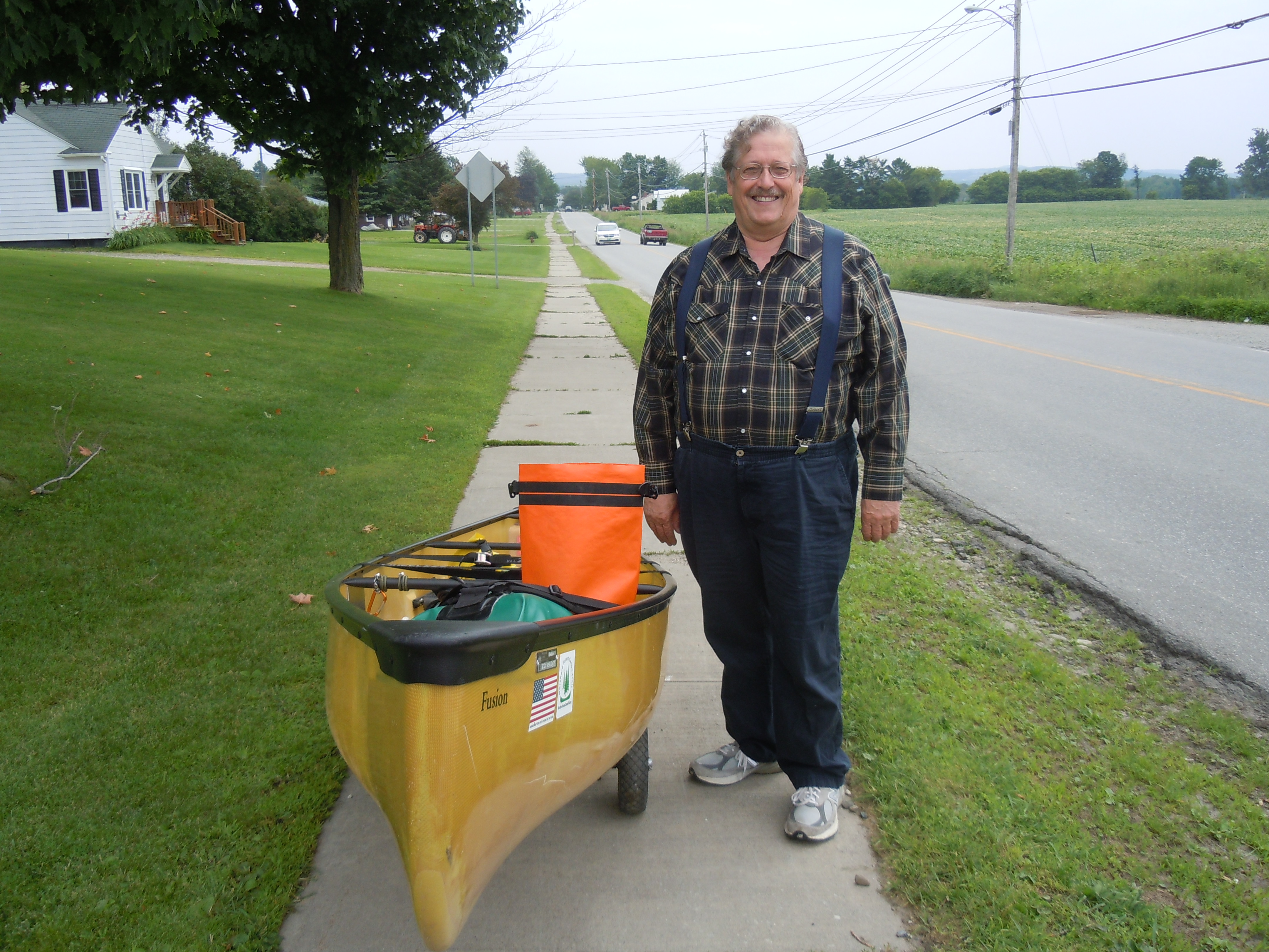
I was glad I had paddled all of the lake yesterday and could relax and enjoy the fellowship.  I was graciously invited back for another night, but carried all my stuff with me to be honest.  On the drive to the Oquossuc Carry Rd., which Janie walked with me, we saw a fox!

Rangeley Lake was bursting with friendly people kayaking and enjoying their docks.  It was the essence of summer fun and jubilant moods.  One woman in particular asked me how far I had come, then laughed when I told her 445 miles.  Until I introduced her to the NFCT, when she proceeded to cheer as I paddled away.  Reactions like hers are very energizing!


Official photo at Lakeside Park, commemorating the completion of Rangeley Lake and Map 8.

 
“Laurie,” came a shout as I was navigating the parked cars. Amazingly, it was Beth and Paul Whelan (2014 Through-Paddlers), who didn’t have any trouble spotting me out walking my canoe. Wonderful to get a hug and know that they have been reading along on my blog. I’m already looking forward to the Maine Canoe Symposium next year.
 

PADDLER’S NOTE:  My GPS only measured 6.8 miles, less than the map indicated, on Rangeley Lake.  The very nice women at Ecopelagicon verified the new portage route, but really had no information on river conditions.  

The new portage through Haley Pond is a welcome improvement – good signage, pleasant trail with sturdy bog bridges, and NFCT interns Matt and Evan were at the museum shelter ready to install a moldering privy near the lean-to during this week’s NFCT work trip.  

A mountaintop experience to end the day, as Paul and Janie drove me to the top of Quill Hill, 12 minutes up a purely scenic road built by a generous soul who made a fortune in construction and logging. Check it out if you are ever in the area.

TOTAL MILES: 450.0 


Day 31: Spaulding Cove in The Narrows to Haines Landing in Oquossuc and the Hartman’s cabin, Cup o’ Tea (14.8 miles)

Jess and Becca certainly became trail angels when they offered to share their campsite with this NFCT through paddler, just as lightning began to threaten.

All three of us were up early, ready to paddle the 6 miles to Upper Dam in the early morning calm.  The storms in the night had been intense and right overhead, so we were glad to see sun.

As I paddled with a gentle wind at my back, awed by the flight of a calm and majestic bald eagle, across the water came the faint sound of singing from the girls’ yellow canoe.  

“I bet they’re singing camp songs,” I thought, knowing Megan would have enjoyed them and their enthusiasm for my trip.  They were athletic and comfortable with camp life…Becca plays field hockey like I did in college and Jess has been on many wilderness trips, including 30 days canoeing in the Boundary Waters.  


Two wilderness paddling enthusiasts (Jess and Becca) portaging Upper Dam

At Upper Dam, I was pleased to find phone service and quickly called Paul and Janie Hartman.  Instead of paddling to their cabin, could I please finish all of Mooselookmeguntic Lake and get picked up in Oquossuc?  It was settled and off I paddled onto another idyllic lake on another idyllic day.  I am so blessed to be on this trip!  Although the wind did come up and I paddled deep into Wildwood Cove to stay safe.


Old friends and part of my church family, Paul and Janie have owned their place on Mooselookmeguntic Lake for almost forty-seven years

As always, the details fell into place.  A man pulling his boat pointed me to Cliff’s cabin, where Cliff was happy to store my boat overnight.  Paul and Janie whisked me off for some Yellow Brick Road ice cream at The Gingerbread House and then home to their cabin for an evening of visiting.

Cup o’ Tea is a place of traditions. One of my favorites is the outdoor shower, with plenty of water out in God’s creation and a view of the sun-sparkled lake. Did you notice the water comes out of a hollow tree?

TOTAL MILES: 439.9 

Day 30: Peace of Heaven Bed and Breakfast in Millsfield (after Errol dam portage) to Spaulding Cove, The Narrows (15.8 miles) 

Sonja takes hospitality seriously, sharing her phone, scissors to make a fresh pot cozy, and fixing a generous breakfast of fruit, zucchini bread, eggs, bacon, and French toast. That should get me to the Richardson Lakes, my goal for today.

Here is a fascinating fact you surely do not know.  Our bed and breakfast (Peace of Heaven) is the official Town Hall for Millsfield, NH, where citizens vote in the bedrooms behind closed doors.  In 2014, the Secretary of State visited Sonja to see how it all worked.  Check out the ballot box below, which is waiting for the primaries.  Look for them on national news in September.

Heavy rain, that made me think of Lake Champlain, pounded the river as I finished the last three miles of the Androscoggin into Umbagog Lake.  Fittingly, though, the sun was emerging as I crossed the state line into Maine and continued to where the lake narrows as it approaches the Rapid River.

This section of the wildlife refuge has the feel of a wild, remote river.  Happily, I had retrieved my binoculars (missed them too much) and had them close at hand.  There, in a dark tangle of branches on a fallen log, something moved.  A brown body slid into the water.  An otter, I discovered, the first of the trip.  It moved around the boat, its glistening periscope head emerging several times to study me, chattering a complaint at my presence.

At the Cedar Stump campsites, any feeling of remoteness quickly vanished: kids in whitewater kayaks, rafters, fishermen…it was a full houseI

PADDLER’S NOTE: I carried the canoe and gear separately for the first half mile.  After that, the rest of the Carry Rd.was barely wheelable with much perseverance – rocks, deep soft puddles, and ruts.  I used Pond in the River, but think it added extra work.

A couple of miles into the portage, I came upon Sydney’s canoe resting there without gear, wheels, or friends. I soon found them, discouraged and justifiably tired.  The new wheels had failed to arrive and the rigors of the Carry Rd. were too much for the old ones.  I offered to try to send back a pickup truck to help.  Finding no one at Forest Lodge, I went on to the camp at Middle Dam, where they said they would send a truck.  I will be anxious to hear how it all worked out!

Forest Lodge, once the home of Louise Dickenson Rich, author of We Took to the Woods, lies along the Carry Rd. and in 2011 was owned by Aldro French, who invited me in for a bountiful breakfast. I had hoped to learn how he was, but no one was home.

“No worries” is an expression much loved by Megan’s generation and a blessing to hear from two generous young women offering to share their campsite.  I was quite tired, the first glimpses of lightning had arrived, and all the campsites in The Narrows between the two Richardson Lakes were full.  Gratefully, I squeezed my tent into a little area just made for it and ate my backcountry Thanksgiving dinner while they had their chili.  I will introduce you tomorrow!

TOTAL MILES: 425.1

Day 29: Androscoggin River campsite to Peace of Heaven Bed and Breakfast in Errol, NH (7.9 miles)

A rainy morning that started with a very early walk along quiet Route 16 to Mollidgewock State Park and the last few miles of the Androscoggin.

Today I became an NFCT Section Paddler, which means I have now completed all of the NFCT in two different years.  I’m also almost to Maine, my home state, the state with only 7 miles of upstream trail!  Today’s plan of rising very early to walk newly-paved Route 16 without traffic worked like a charm and I was in Errol and finished with the portage around Errol Dam in time for breakfast.

Ricky at The Errol Motel went above and beyond in holding a room and storing my boat until I could get in touch with Mom and Dad.  Turns out the motel had been full when Dad called for a reservation, so we are here at the Peace of Heaven B&B enjoying Sonja Sheldon’s friendly hospitality.

Signing in at the Errol kiosk, finished with Map 7.
I ate three delicious meals at the Northern Exposure Restaurant in Errol and their Black Bear Pub, where they let me write for hours.
We all loved Debbie down in the pub, who kept us laughing all evening.

TOTAL MILES: 409.3

Sharing scenes from my journey

DSCN7301
Gazebo in Mansonville, Quebec with the most original piano ever
DSCN7362
Ray stopped alongside on my walk to Salem Lake to ask me for advice on wheels for his new and heavy canoe…he is a square dance caller
DSCN7445
Need I say more…the perfect Clif bar for past weeks
DSCN7449
Church that welcomes you to the town of Island Pond, VT
DSCN7470
First noticed these wildflowers on the Nulhegan, but have been seeing them since…anyone know their name?
DSCN7474
Fledgling bird on the Nulhegan River – I found out what species when several redwing blackbirds began wheeling and screaming overhead.
DSCN7480
Moose observation platform where I ate my snack on the long walk past technical rapids on the Nulhegan
DSCN7491
Time to try some creative photography on a barn near my VRC campsite
DSCN7504
Stained glass windows on the North Stratford Baptist church
DSCN7509
Weather is building at the start of my Connecticut River race for camp
DSCN7528
Family of mergansers reflected in the early morning river

Day 28: Cedar Pond Campground to stealth campsite on the Androscoggin River (15.3 miles)

Another upstream river?  Are you crazy?  Did the Abenaki really go up all these rivers?  Well, I like to think so and also that they would approve of my decisions as to when to do a little extra walking, like today.

Many through paddlers extend the official portage between the Ammo and the Andro by walking farther to Pontook Reservoir, avoiding these rapids.
Susan and Gordon…did you move back to New Hampshire and not tell us?
The Androscoggin River was broad and beautiful, except for when it was rushing and shallow and full of rapids. The mile and a half above the reservoir was incredibly slow and difficult, with strands of slippery green algae covering the rounded river rocks.

I want to tell you the story of day’s end.  After the 4-mile walk and the easy paddling and the horrible 1.5 miles and some more easy paddling and a short portage around Seven Islands Bridge.  The day was supposed to end with a long walk to a state park to camp and be poised to meet Mom and Dad tomorrow in Errol.

Here is another critical trail skill – creative problem solving.  I had passed the bridge, had the boat perfectly balanced on the wheels, and was ready to walk as long as it took to get to the state park.  Not to be.  Route 16 is being repaved and has CLIFFS at the edge and tons of traffic.

So back to the river I went, somewhat reluctantly, but paddling strong until I passed the group of young adults unloading canoes at Osprey and a couple of fly fisherman drifting in a rowboat.  Now I could collapse.  The site I picked was perfect, except for the fact it was so close to the road that I had to wait until dusk to put up my tent.  In the meantime, I cooked pasta and salmon and looked for bears.  As soon as the tent was finally up, I was sound asleep!

TOTAL MILES: 401.4 

Day 27: Upper Ammonoosuc campsite to Cedar Pond Campground (9.8 miles)

Woke at 5:15, to find it even cooler than when I groped for my warm hat in the night.  After apple oatmeal and coffee, the sun gradually warmed the air, as ravens croaked and flying loons called, perhaps also feeling the welcoming spirit of this place and time.  My soul longed to rest a while and so I did, eventually departing mid-morning.


This was the view mile after mile, slow paddling through a blue and gold and green world. I think i saw a coyote this morning and will confirm by checking my photos of its tracks.
  
Even an uncovered railroad bridge makes a valuable motivational landmark after hours of paddling – one and a half miles to go.
  
Many of those following my adventure may want to consider joining the Northern Forest Canoe Trail and supporting all of their essential work (like the Cordwell campsite steps and privy). Although I didn’t stay here, I appreciated all of the hard work of trail maintainers such as “Excelsior.”

PADDLER’S NOTE:  Gord, whose store is located at the end of the Upper Ammonoosuc River, and Cedar Pond Campground, along the portage route to the Androscoggin River, come highly recommended.  Gord found me a place to charge my phone while I ate one of his FRESH roast beef sandwiches.  And Cedar Pond’s tenting area is perfectly set up.  I especially enjoyed the phone charging station and nice hot shower with a drawing of how to work the “pointer” to get hot water.  Am I the only one who has trouble figuring out how to operate a new shower?

TOTAL MILES: 386.1

TOTAL MILES: 9.8

Day 26: Danforth home (stopped at Weston Dam) to stealth campsite on the Upper Ammonoosuc River (14.1 miles)


Our home for a day in Shelburne, NH, where Ray and Hildy Danforth are celebrating their 48th anniversary today… wishing you many more contented and adventurous years together!
 
Not my best look, but wanted you to see new friends Ray and Hildy…just don’t focus on my shirt!

The overnight rain was clearing by the time we left Ray and Hildy’s, filled to bursting with scrambled eggs, bacon, English muffins, homemade jam, and fruit.  That should power me for a while up the Upper Ammonoosuc River today!

The NFCT goes under this covered bridge in Groveton, in the midst of 3 consecutive dam portages. Utilizing Ray and Hildy’s local knowledge, I walked after the third dam (Red Dam) for 2.7 miles, adding to the portage length due to shallow water conditions.

PADDLER’S NOTE:  Good decision to continue portaging past Red Dam on 110 and Emerson Rd.  At the Emerson Rd. bridge, there is a great put-in on river right, downstream, where a wheelable “road” goes down from the far end of the guardrail.  From this bridge, it was a half hour struggle to get past Nash Stream and out of sight of the bridge, but then an easy 2 miles.

Beauty along the roadside

The trail has taught me, not only to look on the bright side, but also to appreciate the gentle times, without worrying too much about what lies ahead.  For two miles, I searched for moose and delighted in the songs of the thrushes and cheered on the bit of blue sky that peeked through the clouds.  

My goal was that lovely village of Stark, but first the river grew increasingly troublesome…with faster current and shallow sand and gravel bars.  As the hours and miles go by, legs tire, rocks seem more slippery, and one must rely more on determination and mental attitude.   It is then that I try to be more analytical…what could go wrong and how can I stay safest?  I guess I succeeded, as eventually the covered bridge appeared.  (The last section from the Frizzell campsite took 80 minutes to go 1.3 miles.)

The village of Stark was even more alluring after finishing the most difficult miles of the Upper Ammonoosuc River.
  
Continued by portaging a one-mile boulder field above Stark, where the river truly relaxed, at least as far as this perfect stealth site. After getting everything, including my canoe, up a wicked steep bank , the world held all I could hope for for a peaceful night and lingering morning.
 

 TOTAL MILES:  376.3 

Day 25: Samuel Benton campsite on the Connecticut River to the home of Ray and Hildy Danforth (10.1 miles)

Peaceful, sunny morning to finish the Connecticut River and start up the Ammonoosuc as far as Groveton, NH.

Recipe for hospitality for NFCT through-paddlers:

1. Pick up paddlers and countless pieces of gear and equipment, filling vehicle to bursting.

2.  Drive the long way home (who cares about gas), visiting covered bridges, ski jumps, logging boom relics, and towering mountains.

3.  Also scout rivers ahead, sharing river conditions, portaging suggestions and other valuable wisdom.

4.  Stop at grocery store.

5.  Bring smelly, tired, famished paddlers and afore-mentioned gear, also smelly (and wet), into your home.

6.  Provide tea, homegrown peas and hummus, showers, beds, laundry facilities, home cooked supper, well water, grease (for wheels), band aids, coffee packets, more time poring over maps, and warm, caring hearts.

Thank you, Ray and Hildy, for sharing your home, with its comfortable country cottage atmosphere, and making Sydney, Marji, and I a part of your family for a day.  Hope we will paddle together one day!

TOTAL MILES: 362.2

Marji, Ray, Hildy, and Sydney by the recently-restored covered bridge in Stark, NH, which lies about 8 and 1/2 miles up the Ammonoosuc River from Groveton. This calendar-worthy village is named for John Stark, a French and Indian War hero whose words “Live free or die” appear on the state’s license plate.
For my friends at the Bremen Union Church, praying me safely along the way…here is the picturesque Stark Union Church, which reminded me of all of you.

Day 24: VRC site East Branch Nulhegan to the Samuel Benton campsite on the Connecticut River (16.6 miles)

I woke to the pleasant sound of the gurgling stream and none of the predicted rain.  The weather has just been beautiful, day after day after day.  I feel so badly for Peter, who did most of the NFCT in the rain in 2013!

I had considered returning to the water for the last couple miles of the Nulhegan, but the access down the East Branch by my campsite was just too shallow and rocky.  

The East Branch of the Nulhegan near my tent

Instead, I walked again, rewarded with cool morning air, a picturesque barn to photograph, a deer, and a cemetery.  There were Wheelers  (my mother’s maiden name) buried there, but also many with French names.  The inscription on the stone below was actually written in French.  
  

Bloomfield, VT and North Stratford, NH mark the end of Map 6 (official photo below) and the start of a much-anticipated 20-mile paddle down the wide, speedy, straight, glorious Connecticut River.  So after a very long time in Claudette and Dean’s Place, fueling up and writing, the distant rumble of thunder sent me scurrying to get started.


There are nothing like towering clouds and a single bolt of lightning to keep you moving along.  Past a sulphurous spring that the Abenaki and early settlers believed had healing powers.  Past a bald eagle wheeling against an angry gray sky.  On flowed the wide Connecticut with occasional rips or easy rapids, toward the first possible campsite near the granite foundation of an old railroad trestle.

Safely arrived, there was a very familiar green canoe…Sydney and Marji had taken a shuttle from Island Pond to Bloomfield after their new wheels failed to arrive.  They reported that this campsite was dismal, making the decision to go on another 6 miles an easy one.  The storms passed and we set up camp at this site with a sandy beach, new composting toilet, and lots of flat tent space at the edge of a hayfield.  Tonight I had mosquitoes for company instead of black flies, so it was a quick swim and avocado, tortillas, fruit salad, and tea for supper.

TOTAL MILES: 352.1

Late evening on the Connecticut, weary and hoping that the next campsite will be more attractive.
Sunset gilds the sky and my tent…and I feel thankful for generous landowners like this farmer who allow camping on their property.