


Bright morning sunshine and early head winds were with me as I finished Brassua Lake, where the dam doesn’t come into view until you round the point and are right there. I love heading confidently right to this portage, which is marked by towering piles of dri-ki (giant driftwood).


The rapids as I returned to the Moose River were on a par with those of yesterday, one perhaps a Class II with fun standing waves. A fly fisherman in waders reported a good morning’s catch of “brookies” and salmon and, not for the first time, I wished there had been space and time for fishing.

I resisted the temptation to be lazy and instead paddled into the wind to sign in at the Rockwood kiosk, before turning and sailing in style down to The Birches. An old family favorite, this lodge has all the rustic charm of bygone days and staff and owner who we count as good friends. Tomorrow will be my one and only rest day, a chance to recharge and reorganize for the wilderness sojourn ahead.
TOTAL MILES: 577.2
Wow, I am blogging from my tent as dusk falls, determined to post this before it gets dark. This week I’ve had many long, tough days and my body is begging for a rest. Again this afternoon, I was digging deep to keep paddling until I reached camp.
The day began with bright sunshine as I finished Long Pond, paddled a short section of the Moose River and then tackled the almost four-mile Demo Rd. portage to reach Little Brassua and Brassua Lakes and my island camp.


TOTAL MILES: 567.2
(Just discovered that I have four bars on my phone and can actually blog from the trail, my original hope for my trail writing. It is now tomorrow!)
So, it was another five miles into Jackman, which I could not have endured last night. So good decision to stop and camp.
This morning, paddling into town went easily and I was grateful for no float plane traffic on Big Wood Pond, just a couple of planes tied up near the Jackman Landing Campground, where I took advantage of their nice laundry. Then on to my favorite Jackman restaurant, Mama Bear’s for a turkey BLT, fries, brownie sundae, and some writing.

The seven-mile stretch of the Moose River out of Jackman is a relaxing paddle. I saw a deer, that snorted as I was drifting and reading my map, and also was very unobservant in not noticing a giant deadfall tree full of ospreys until after they took flight! That was just as I entered Long Pond from the river (below).

Tonight is what camping should be. This was my third time trying to camp in this site on the Lower Narrows of Long Pond and I made it. On the 2006 Map 10, it is in the wrong location, but this time I knew right where to head.

TOTAL MILES: 550.8
When I look back over today, the words that come to mind are “photos” and “exhaustion.”
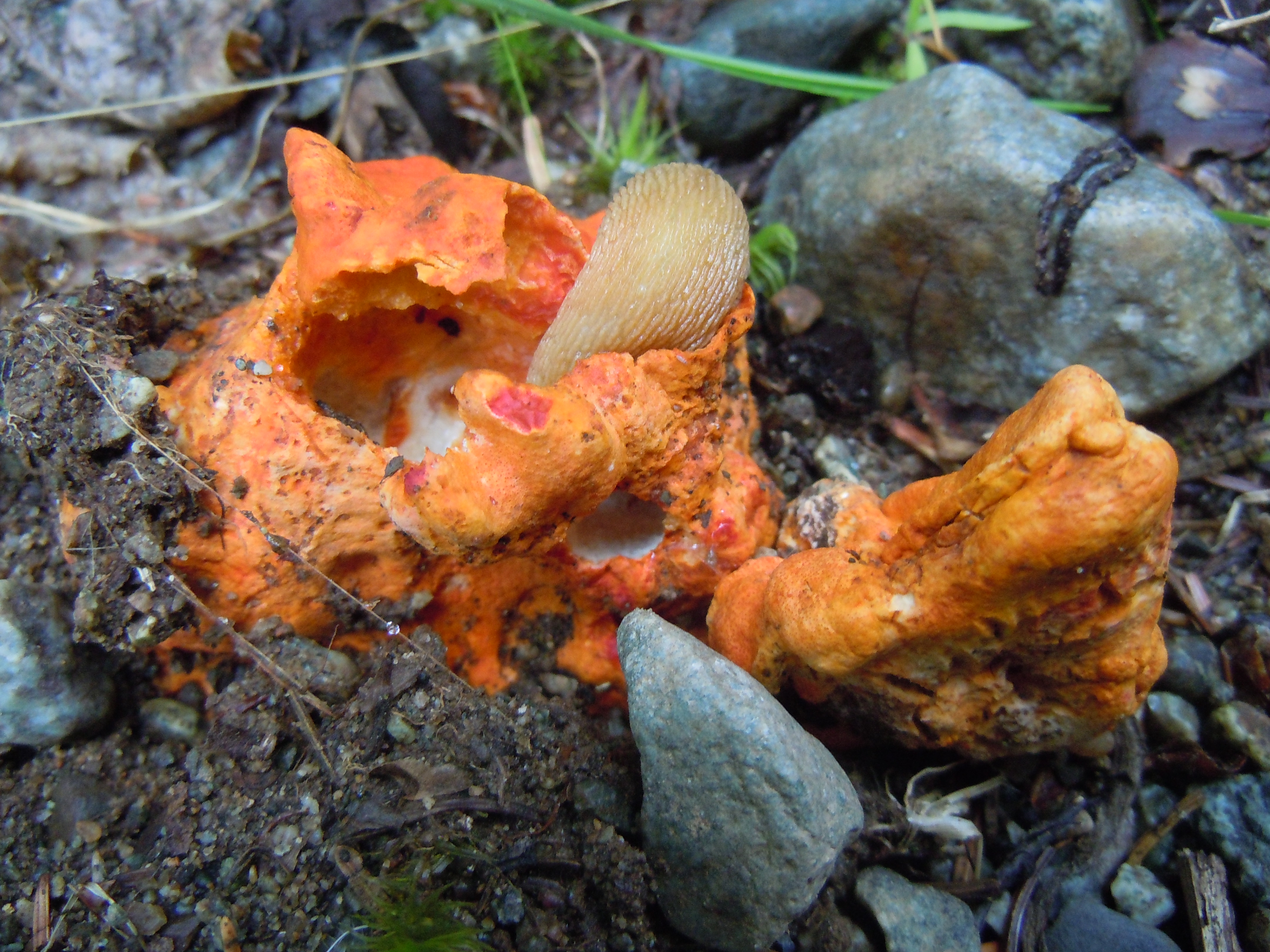
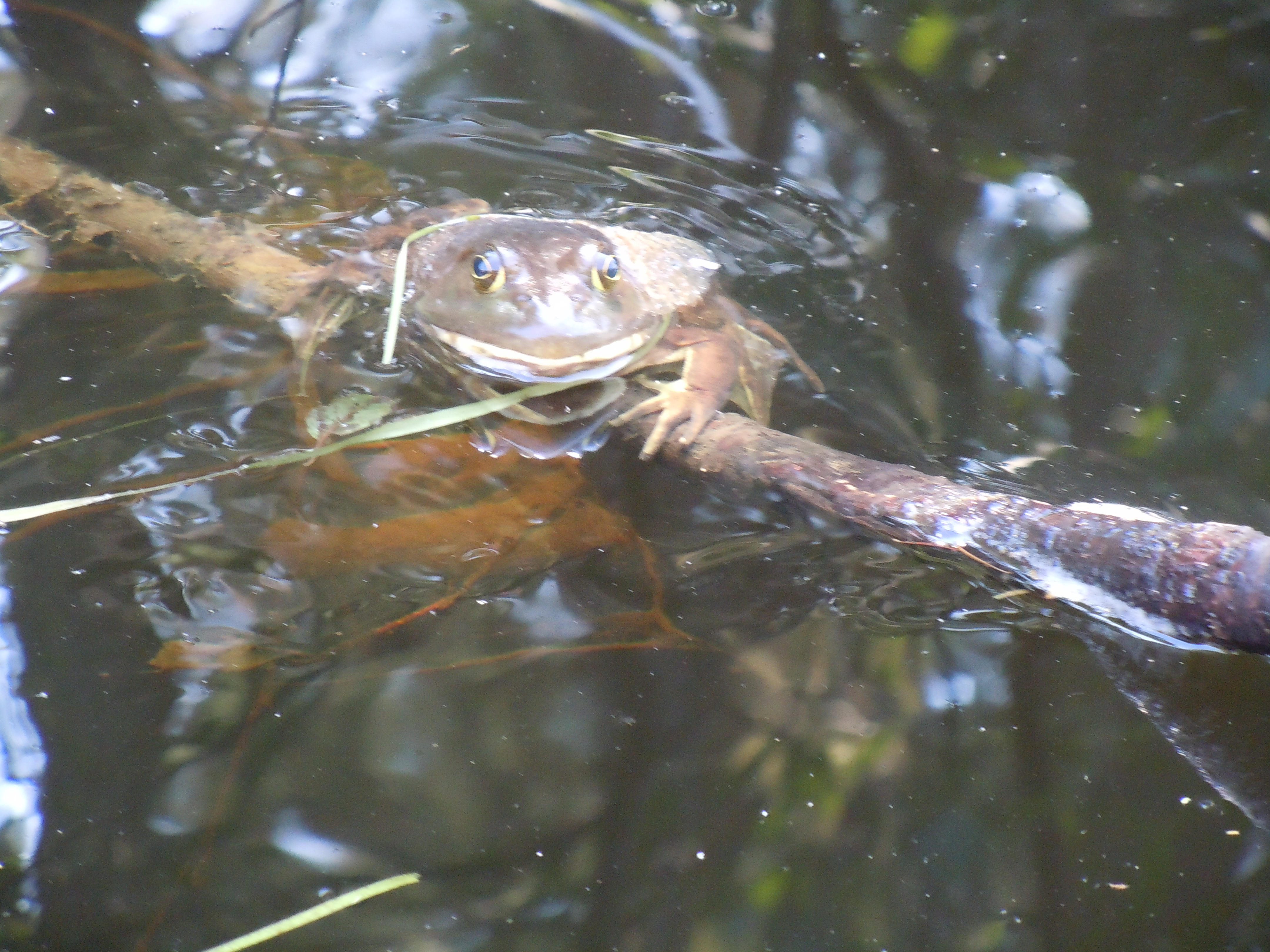
On my camera (not this phone) are lots of great memories from this day of walking six miles of logging roads and paddling a spectacular route along the Moose River and across Attean Pond…flowers, ripe raspberries that drastically slowed my progress, a laid back frog, and some massive glacial erratics. I love that phrase, “glacial erratics,” God’s punctuation on a river of immense beauty. So look for those soon on a blog post near you.


Time to finish writing for today, but I will be happy to hear news of Sydney and Marji, whose new wheels broke yesterday on the long portage! Help was on the way and I hope it arrived. I was too exhausted to reach Jackman, particularly with towering, black clouds and the rumble of thunder. Found a nice empty site at Sally Mt. Beach, safe from the severe line of storms that came through during the night.
TOTAL MILES: 534.9

For four years, I’ve been saying, “I paddled all of Maine except for seven miles, the upstream part on Spencer and Little Spencer Streams.” This was the day to finally meet the challenge of the hardest stretch in Maine and I was ready, waving goodbye to Taylor as he headed back to Virginia.

PADDLER’S NOTE: As with the South Branch of the Dead River, I took detailed notes. The ascent of both streams, a distance of 7.0 miles, took me 6 hours and 20 minutes. Water levels must have been in my favor, because I did not have to unload my boat at all, nor lift over any dams.
The first and last miles required the most and slipperiest walking. My GPS showed 2.4 miles and 2 hours to the confluence of the two streams. Every mile had intermittent portions that could be paddled, for anywhere from 35 to 300 paddle strokes. The easiest mile or more was around Parker and Parker Bog Brooks.
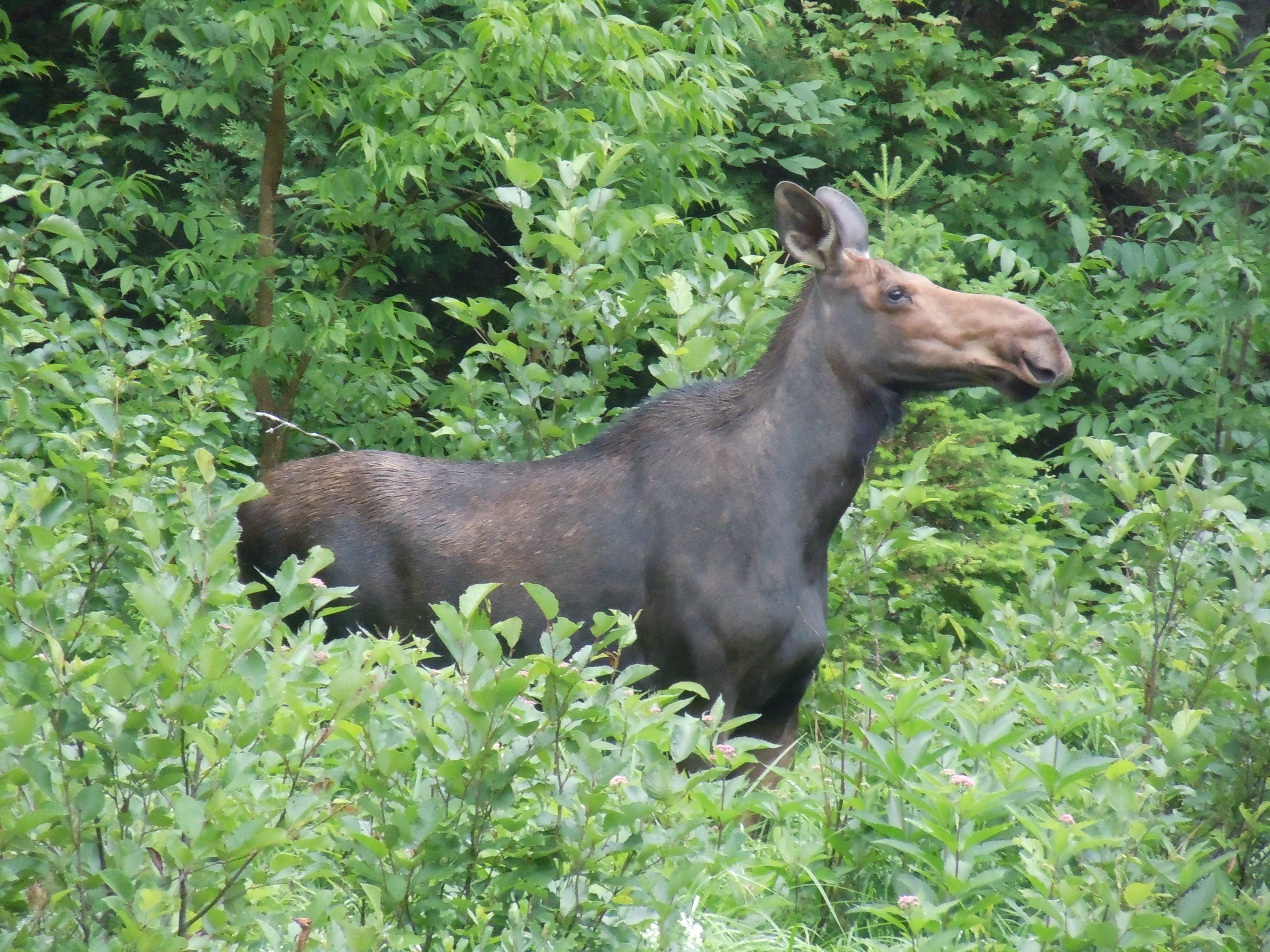
Enough notes! As I was tucked up under a ferny, licheny, brownish-gray wall of rock, enjoying Sarah’s no-bake chocolate, peanut butter, oatmeal cookie, I heard a soft squeal. I looked up into the eyes of a moose…the first of my trip…on dreaded Little Spencer Stream, no less. She puzzled me out, then settled comfortably for a while, until I said softly, “I won’t hurt you. I’m going to go and leave this place to you.” But when I moved, she faded into the brush.
PADDLER’S NOTE: I easily found the portage (to take you around the dam without ascending a rock cliff) at the top of Middle Deadwater just below the rapids. The aluminum boat was there as promised, as well as a green canoe. After a short carry up a smooth trail, it was wheelable the rest of the way to Spencer Lake.
By then I was exhausted, but a tail wind pushed me along up to the campground at Fish Pond, where Sydney and Marji later joined me. We had the campground to ourselves, although the one on Spencer Lake had been full. Went to bed quite content.
TOTAL MILES: 516.8
After dozing off so early, I was up at 4:30 and soon gone, motivated by a much-anticipated rendezvous…my son Taylor and parents were meeting me at Grand Falls Hut for the night.
PADDLER’S NOTE: My total mileage for Flagstaff Lake following the north shore and camping on the island was only 19.1 miles. At Long Falls Dam, I used the road portage option and put in at Big Eddy, passing a short trail that led to a view of Long Falls.

A bit of moving water started me out on a peaceful 6.5 miles of the Dead River. Eagles, kingfishers, and mergansers there were in abundance, but none of the large mammals I hoped for in the early morning, drifting gently around the river’s curves. It was still beautiful, though.


Map 9 is finished…where are the days, the weeks going to? (The official photo taken at the bottom of Spencer stream won’t upload).
Mom made a big effort to hike into the Grand Falls Hut, but she survived and especially enjoyed all the bunchberries along the trail. Seeing Taylor again after six months was the best…we walked back to Grand Fall, saw a doe nibbling leaves, and I stayed up until the late hour of 9:30 playing Uno and visiting with the other guests. Thanks to staff Nate and Sarah for great food and care, especially my grilled cheese.

TOTAL MILES: 503.0
There is magic in the feel of a paddle and the movement of a canoe, a magic compounded of distance, adventure, solitude, and peace…Sigurd Olson
Thank you, Nancy and Arne Aho, for inspiring me with words from an author who was surely a kindred spirit, Sigurd Olson. Someday I will paddle the lands of which he writes so vividly.
Mary sent me off well fed and with enough food for the day, especially simple foods I had been craving, like yogurt, hard-boiled eggs, and carrots. It was nice to have someone wave me off, as I paddled from the White Wolf Inn through a creek and into the lake.

The cadence of my paddle, grandeur of the Bigelows marching along the water, the warring weather, with mist and rain the victor, all combined to put me in a poetic mood. There is a poem simmering inside me about this day, just waiting to be finished.

I ate lunch on Hurricane Island, where I thought nostalgically of the note that Timm and Sal had left for me there during Paddle for Hope. Today the island has a newer journal that only goes back to 2013. Sydney, Marji, and I all put in a lot of miles with the wind at our backs…18 miles to the last campsite on an island in Flagstaff Lake. Other than noting the serenading of many loons, I journaled little, had yogurt for supper, read a bit, and fell asleep wicked early!
TOTAL MILES: 493.2

It’s rather a long walk from the Kennebago Rd. bridge to the town of Stratton for everyone, due to difficult rapids even when water levels are high. Thankfully, the miles flew by, mostly downhill with comfortable temperatures and interesting sights.

Next a raccoon, which joins whitetail deer, red and gray squirrel, beaver, mink, chipmunk, otter, and gray fox on my mammal list for this trip, so far.


So, my day of paddling (let me change that to walking) ended in time for lunch at the White Wolf Inn. A leisurely and delicious grilled chicken sandwich with fries and pecan pie while I did my writing.
The kind folks there, who are so welcoming to AT hikers, too, willingly stored my boat overnight while I relaxed at Sugarloaf, thanks to Mary Berger. Mary worked out her always-busy schedule to whisk me away for an evening of hot tubs, bathrobes, and soft beds. An added bonus was a surprise chance to visit with most of our wonderful GSB bus drivers, who were there for a meeting.
I AM SO BUMMED I FORGOT TO TAKE A PICTURE OF YOU ALL..if someone took one of you having dinner at The Rack I could insert it here!

TOTAL MILES: 475.0


Noah encouraged me to paddle some today. What’s unusual about that? Typically, this time of the summer, the South Branch of the Dead River is dead (water too low for paddling). And not knowing, many through-paddlers do not attempt any of this section, instead taking a shuttle or walking 23 miles! I had my heart set on at least trying and then sharing the results with other paddlers.
PADDLER’S NOTE: I successfully (with some effort) paddled about 9 miles of the South Branch of the Dead River. Walking to the Dallas Carry put-in from the museum was 3.5, not 2.5, miles.
From Dallas Carry to the Fansanger Falls portage was 2.4 miles, including parts like the Nulhegan and parts like the deeper Clyde. Obstacles included over and under a couple of fallen trees, Class I rapids that were also shallow, and out of boat for perhaps 8 boulder gardens, worse near end. This section took 1.5 hours.


PADDLER’S NOTE: Some kayakers thought I could put in at the bridge a mile before the Langtown Mill bridge, but there was a large fishing audience, steep bank, and I continued walking.
The 6.7 miles from the Langtown Mill bridge to the Kennebago Rd. bridge gets deeper, calmer, and less rocky as you progress. The first three miles included a huge tree across the river that required a actual portage; fast, sweeping turns with strainers; some fun rapids; and at least a dozen times out of the canoe walking.
The day ended excellently with a perfectly-mown stealth campsite complete with approximately 10,000 black flies and mosquitoes. I cooked and ate my burritos from the tent.
TOTAL MILES: 465.9
