Day 37: Start of Spencer Stream and Grand Falls Hut to Fish Pond campground site #5 (13.8 miles)


Family togetherness at the Grand Falls Hut
 
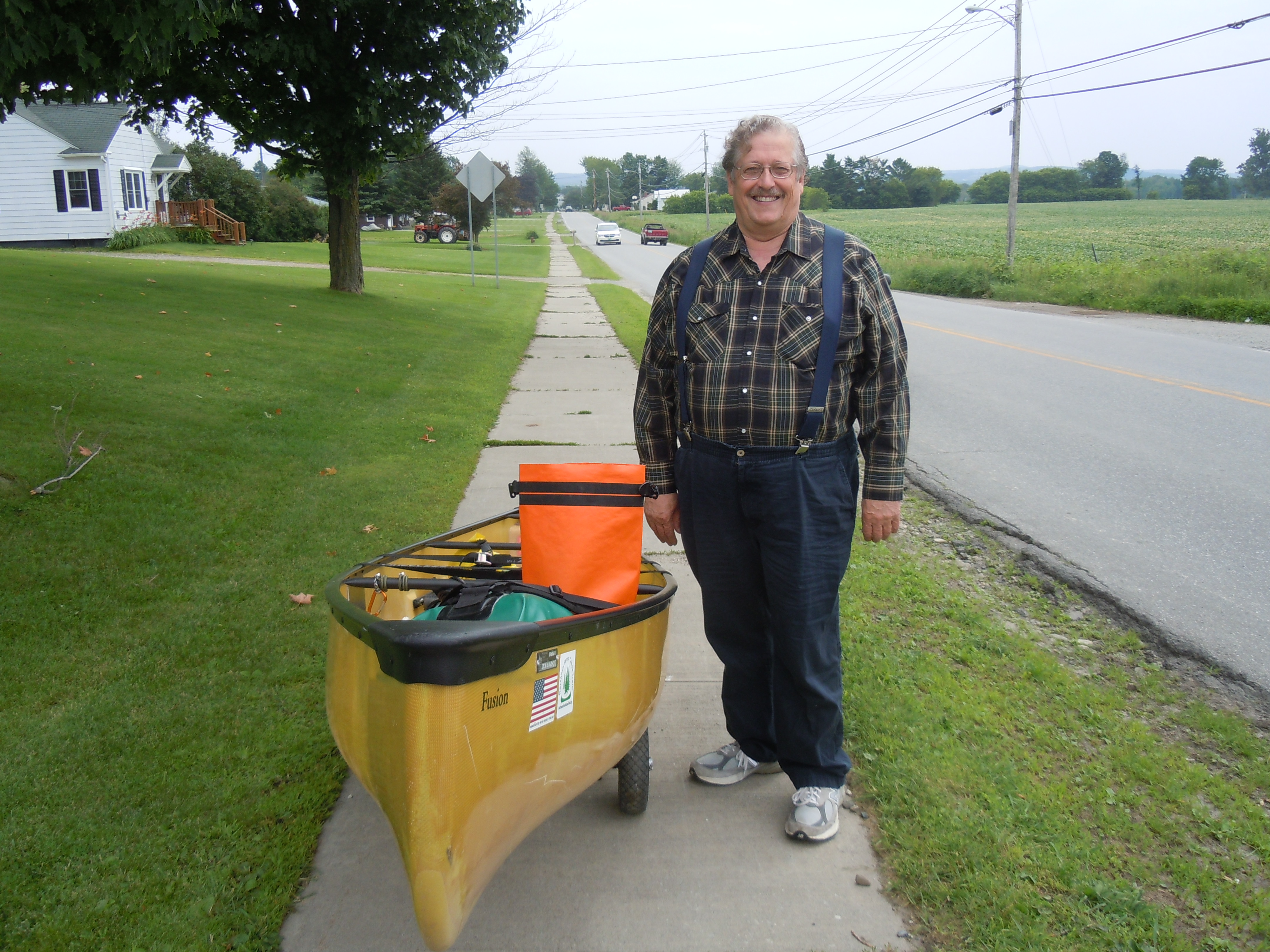
For four years, I’ve been saying, “I paddled all of Maine except for seven miles, the upstream part on Spencer and Little Spencer Streams.”  This was the day to finally meet the challenge of the hardest stretch in Maine and I was ready, waving goodbye to Taylor as he headed back to Virginia.

Selfie at the confluence of Spencer and Little Spencer Streams…I am finally meeting the challenge!

PADDLER’S NOTE:  As with the South Branch of the Dead River, I took detailed notes.  The ascent of both streams, a distance of 7.0 miles, took me 6 hours and 20 minutes.  Water levels must have been in my favor, because I did not have to unload my boat at all, nor lift over any dams.

The first and last miles required the most and slipperiest walking.  My GPS showed 2.4 miles and 2 hours to the confluence of the two streams.  Every mile had intermittent portions that could be paddled, for anywhere from 35 to 300 paddle strokes.  The easiest mile or more was around Parker and Parker Bog Brooks.

Enough notes!  As I was tucked up under a ferny, licheny, brownish-gray wall of rock, enjoying Sarah’s no-bake chocolate, peanut butter, oatmeal cookie, I heard a soft squeal.  I looked up into the eyes of a moose…the first of my trip…on dreaded Little Spencer Stream, no less.  She puzzled me out, then settled comfortably for a while, until I said softly, “I won’t hurt you.  I’m going to go and leave this place to you.”  But when I moved, she faded into the brush.  

PADDLER’S NOTE: I easily found the portage (to take you around the dam without ascending a rock cliff) at the top of Middle Deadwater just below the rapids.  The aluminum boat was there as promised, as well as a green canoe.  After a short carry up a smooth trail, it was wheelable the rest of the way to Spencer Lake.

By then I was exhausted, but a tail wind pushed me along up to the campground at Fish Pond, where Sydney and Marji later joined me.  We had the campground to ourselves, although the one on Spencer Lake had been full.  Went to bed quite content.

TOTAL MILES: 516.8

Day 36: Flagstaff Lake island near Long Falls Dam to Spencer Stream and Grand Falls Hut (9.8 miles)

After dozing off so early, I was up at 4:30 and soon gone, motivated by a much-anticipated rendezvous…my son Taylor and parents were meeting me at Grand Falls Hut for the night.

PADDLER’S NOTE:  My total mileage for Flagstaff Lake following the north shore and camping on the island was only 19.1 miles.  At Long Falls Dam, I used the road portage option and put in at Big Eddy, passing a short trail that led to a view of Long Falls.  

Long Falls looking up toward the dam and Flagstaff.

A bit of moving water started me out on a peaceful 6.5 miles of the Dead River.  Eagles, kingfishers, and mergansers there were in abundance, but none of the large mammals I hoped for in the early morning, drifting gently around the river’s curves.  It was still beautiful, though.


Forty-foot Grand Falls is audible well before you reach the 1.5 mile portage, which starts at the Maine Huts and Trails aluminum dock. I put the portage yoke to use for the first half mile, before wheeling the rest past the first ripe blueberries of the trip!


Map 9 is finished…where are the days, the weeks going to?  (The official photo taken at the bottom of Spencer stream won’t upload).  

Mom made a big effort to hike into the Grand Falls Hut, but she survived and especially enjoyed all the bunchberries along the trail.  Seeing Taylor again after six months was the best…we walked back to Grand Fall, saw a doe nibbling leaves, and I stayed up until the late hour of 9:30 playing Uno and visiting with the other guests.  Thanks to staff Nate and Sarah for great food and care, especially my grilled cheese.


TOTAL MILES: 503.0

Day 35: Behind the White Wolf Inn in Stratton to island campsite on Flagstaff Lake (18.2 miles)

There is magic in the feel of a paddle and the movement of a canoe, a magic compounded of distance, adventure, solitude, and peace…Sigurd Olson

Thank you, Nancy and Arne Aho, for inspiring me with words from an author who was surely a kindred spirit, Sigurd Olson.  Someday I will paddle the lands of which he writes so vividly.

Mary sent me off well fed and with enough food for the day, especially simple foods I had been craving, like yogurt, hard-boiled eggs, and carrots.  It was nice to have someone wave me off, as I paddled from the White Wolf Inn through a creek and into the lake.

  
The cadence of my paddle, grandeur of the Bigelows marching along the water, the warring weather, with mist and rain the victor, all combined to put me in a poetic mood.  There is a poem simmering inside me about this day, just waiting to be finished.


Marji and Sydney passed me, the first time I’d seen them since the Rapid River. Well, they indeed got rescued in grand style, staying two days in a yurt and visiting with Aldro French! Their new wheels arrived and are serving them well.

I ate lunch on Hurricane Island, where I thought nostalgically of the note that Timm and Sal had left for me there during Paddle for Hope.  Today the island has a newer journal that only goes back to 2013.  Sydney, Marji, and I all put in a lot of miles with the wind at our backs…18 miles to the last campsite on an island in Flagstaff Lake.  Other than noting the serenading of many loons, I journaled little, had yogurt for supper, read a bit, and fell asleep wicked early!

TOTAL MILES:  493.2

Day 34: South Branch of the Dead River to Stratton and Sugarloaf (9.1 miles)

Dawn stirs the soul with the gift of another day

It’s rather a long walk from the Kennebago Rd. bridge to the town of Stratton for everyone, due to difficult rapids even when water levels are high.  Thankfully, the miles flew by, mostly downhill with comfortable temperatures and interesting sights.


The Coplin Plantation Schoolhouse, circa 1845, sits on a great stone foundation.

Next a raccoon, which joins whitetail deer, red and gray squirrel, beaver, mink, chipmunk, otter, and gray fox on my mammal list for this trip, so far.

Dramatic skies have been a daily companion, keeping me guessing about the weather. Later in the evening, we had a massive downpour.


Ralph, whose son at SMU is doing a summer project about the NFCT, visited with me coming and going to town to get the morning paper. Ralph also met Mack Truax on his through-paddle…it was someone walking a sea kayak…must have been Mack!


Here’s what the kiosk in Stratton has to say about the South Branch of the Dead River…perhaps I was helped by the thunderstorms passing through.

So, my day of paddling (let me change that to walking) ended in time for lunch at the White Wolf Inn.  A leisurely and delicious grilled chicken sandwich with fries and pecan pie while I did my writing.  

The kind folks there, who are so welcoming to AT hikers, too, willingly stored my boat overnight while I relaxed at Sugarloaf, thanks to Mary Berger.  Mary worked out her always-busy schedule to whisk me away for an evening of hot tubs, bathrobes, and soft beds.  An added bonus was a surprise chance to visit with most of our wonderful GSB bus drivers, who were there for a meeting.

I AM SO BUMMED I FORGOT TO TAKE A PICTURE OF YOU ALL..if someone took one of you having dinner at The Rack I could insert it here!


I love this photo…between the hot tub and visiting with Mary, body and spirit are rested and renewed!

TOTAL MILES: 475.0 

Day 33: Maine Forestry Museum to stealth campsite on the South Branch of the Dead River (15.9 miles)

I believe Janie and Paul could actually fatten me up while I was paddling and portaging long distances every day. Today, homemade waffles to begin what I knew would be a challenging day.

Gave Noah (taking photo) and NFCT interns Matt and Evan a huge thanks for their hard work and the promise to return sometime to help with a work trip.

Noah encouraged me to paddle some today.  What’s unusual about that?  Typically, this time of the summer, the South Branch of the Dead River is dead (water too low for paddling).  And not knowing, many through-paddlers do not attempt any of this section, instead taking a shuttle or walking 23 miles!  I had my heart set on at least trying and then sharing the results with other paddlers.

PADDLER’S NOTE:  I successfully (with some effort) paddled about 9 miles of the South Branch of the Dead River.  Walking to the Dallas Carry put-in from the museum was 3.5, not 2.5, miles.

From Dallas Carry to the Fansanger Falls portage was 2.4 miles, including parts like the Nulhegan and parts like the deeper Clyde.  Obstacles included over and under a couple of fallen trees, Class I rapids that were also shallow, and out of boat for perhaps 8 boulder gardens, worse near end.  This section took 1.5 hours.

Today’s flower identification puzzle…thanks to Chris Gill and Janet Dempsey for supplying the name of Swamp Candle, which I also saw in profusion today.

Wouldn’t it have been sad to walk by this?

PADDLER’S NOTE:  Some kayakers thought I could put in at the bridge a mile before the Langtown Mill bridge, but there was a large fishing audience, steep bank, and I continued walking.

The 6.7 miles from the Langtown Mill bridge to the Kennebago Rd. bridge gets deeper, calmer, and less rocky as you progress.  The first three miles included a huge tree across the river that required a actual portage; fast, sweeping turns with strainers; some fun rapids; and at least a dozen times out of the canoe walking.

The day ended excellently with a perfectly-mown stealth campsite complete with approximately 10,000 black flies and mosquitoes.  I cooked and ate my burritos from the tent.

 TOTAL MILES: 465.9

Day 32: Haines Landing, Oquossoc to the Maine Forestry Museum, Rangeley and the Hartman’s cabin again (10.1 miles)

Another great Cup o’ Tea tradition is signing the wooden steps, which still bear the marks of Paul’s father’s measurements during construction.  I added this year’s adventure under my 2011 Paddle for Hope signature.


Paul served omelettes made to order, mine with cheese, tomato, and pepper, along with toast and raspberry jam that Janie had made from local berries…yummy!  We ate on the porch, the lake a mirror, while fog still hovered on the mountains.  

I could happily live on this porch!

I was glad I had paddled all of the lake yesterday and could relax and enjoy the fellowship.  I was graciously invited back for another night, but carried all my stuff with me to be honest.  On the drive to the Oquossuc Carry Rd., which Janie walked with me, we saw a fox!

Rangeley Lake was bursting with friendly people kayaking and enjoying their docks.  It was the essence of summer fun and jubilant moods.  One woman in particular asked me how far I had come, then laughed when I told her 445 miles.  Until I introduced her to the NFCT, when she proceeded to cheer as I paddled away.  Reactions like hers are very energizing!


Official photo at Lakeside Park, commemorating the completion of Rangeley Lake and Map 8.

 
“Laurie,” came a shout as I was navigating the parked cars. Amazingly, it was Beth and Paul Whelan (2014 Through-Paddlers), who didn’t have any trouble spotting me out walking my canoe. Wonderful to get a hug and know that they have been reading along on my blog. I’m already looking forward to the Maine Canoe Symposium next year.
 

PADDLER’S NOTE:  My GPS only measured 6.8 miles, less than the map indicated, on Rangeley Lake.  The very nice women at Ecopelagicon verified the new portage route, but really had no information on river conditions.  

The new portage through Haley Pond is a welcome improvement – good signage, pleasant trail with sturdy bog bridges, and NFCT interns Matt and Evan were at the museum shelter ready to install a moldering privy near the lean-to during this week’s NFCT work trip.  

A mountaintop experience to end the day, as Paul and Janie drove me to the top of Quill Hill, 12 minutes up a purely scenic road built by a generous soul who made a fortune in construction and logging. Check it out if you are ever in the area.

TOTAL MILES: 450.0 


Day 31: Spaulding Cove in The Narrows to Haines Landing in Oquossuc and the Hartman’s cabin, Cup o’ Tea (14.8 miles)

Jess and Becca certainly became trail angels when they offered to share their campsite with this NFCT through paddler, just as lightning began to threaten.

All three of us were up early, ready to paddle the 6 miles to Upper Dam in the early morning calm.  The storms in the night had been intense and right overhead, so we were glad to see sun.

As I paddled with a gentle wind at my back, awed by the flight of a calm and majestic bald eagle, across the water came the faint sound of singing from the girls’ yellow canoe.  

“I bet they’re singing camp songs,” I thought, knowing Megan would have enjoyed them and their enthusiasm for my trip.  They were athletic and comfortable with camp life…Becca plays field hockey like I did in college and Jess has been on many wilderness trips, including 30 days canoeing in the Boundary Waters.  


Two wilderness paddling enthusiasts (Jess and Becca) portaging Upper Dam

At Upper Dam, I was pleased to find phone service and quickly called Paul and Janie Hartman.  Instead of paddling to their cabin, could I please finish all of Mooselookmeguntic Lake and get picked up in Oquossuc?  It was settled and off I paddled onto another idyllic lake on another idyllic day.  I am so blessed to be on this trip!  Although the wind did come up and I paddled deep into Wildwood Cove to stay safe.


Old friends and part of my church family, Paul and Janie have owned their place on Mooselookmeguntic Lake for almost forty-seven years

As always, the details fell into place.  A man pulling his boat pointed me to Cliff’s cabin, where Cliff was happy to store my boat overnight.  Paul and Janie whisked me off for some Yellow Brick Road ice cream at The Gingerbread House and then home to their cabin for an evening of visiting.

Cup o’ Tea is a place of traditions. One of my favorites is the outdoor shower, with plenty of water out in God’s creation and a view of the sun-sparkled lake. Did you notice the water comes out of a hollow tree?

TOTAL MILES: 439.9 

Day 30: Peace of Heaven Bed and Breakfast in Millsfield (after Errol dam portage) to Spaulding Cove, The Narrows (15.8 miles) 

Sonja takes hospitality seriously, sharing her phone, scissors to make a fresh pot cozy, and fixing a generous breakfast of fruit, zucchini bread, eggs, bacon, and French toast. That should get me to the Richardson Lakes, my goal for today.

Here is a fascinating fact you surely do not know.  Our bed and breakfast (Peace of Heaven) is the official Town Hall for Millsfield, NH, where citizens vote in the bedrooms behind closed doors.  In 2014, the Secretary of State visited Sonja to see how it all worked.  Check out the ballot box below, which is waiting for the primaries.  Look for them on national news in September.

Heavy rain, that made me think of Lake Champlain, pounded the river as I finished the last three miles of the Androscoggin into Umbagog Lake.  Fittingly, though, the sun was emerging as I crossed the state line into Maine and continued to where the lake narrows as it approaches the Rapid River.

This section of the wildlife refuge has the feel of a wild, remote river.  Happily, I had retrieved my binoculars (missed them too much) and had them close at hand.  There, in a dark tangle of branches on a fallen log, something moved.  A brown body slid into the water.  An otter, I discovered, the first of the trip.  It moved around the boat, its glistening periscope head emerging several times to study me, chattering a complaint at my presence.

At the Cedar Stump campsites, any feeling of remoteness quickly vanished: kids in whitewater kayaks, rafters, fishermen…it was a full houseI

PADDLER’S NOTE: I carried the canoe and gear separately for the first half mile.  After that, the rest of the Carry Rd.was barely wheelable with much perseverance – rocks, deep soft puddles, and ruts.  I used Pond in the River, but think it added extra work.

A couple of miles into the portage, I came upon Sydney’s canoe resting there without gear, wheels, or friends. I soon found them, discouraged and justifiably tired.  The new wheels had failed to arrive and the rigors of the Carry Rd. were too much for the old ones.  I offered to try to send back a pickup truck to help.  Finding no one at Forest Lodge, I went on to the camp at Middle Dam, where they said they would send a truck.  I will be anxious to hear how it all worked out!

Forest Lodge, once the home of Louise Dickenson Rich, author of We Took to the Woods, lies along the Carry Rd. and in 2011 was owned by Aldro French, who invited me in for a bountiful breakfast. I had hoped to learn how he was, but no one was home.

“No worries” is an expression much loved by Megan’s generation and a blessing to hear from two generous young women offering to share their campsite.  I was quite tired, the first glimpses of lightning had arrived, and all the campsites in The Narrows between the two Richardson Lakes were full.  Gratefully, I squeezed my tent into a little area just made for it and ate my backcountry Thanksgiving dinner while they had their chili.  I will introduce you tomorrow!

TOTAL MILES: 425.1

Day 29: Androscoggin River campsite to Peace of Heaven Bed and Breakfast in Errol, NH (7.9 miles)

A rainy morning that started with a very early walk along quiet Route 16 to Mollidgewock State Park and the last few miles of the Androscoggin.

Today I became an NFCT Section Paddler, which means I have now completed all of the NFCT in two different years.  I’m also almost to Maine, my home state, the state with only 7 miles of upstream trail!  Today’s plan of rising very early to walk newly-paved Route 16 without traffic worked like a charm and I was in Errol and finished with the portage around Errol Dam in time for breakfast.

Ricky at The Errol Motel went above and beyond in holding a room and storing my boat until I could get in touch with Mom and Dad.  Turns out the motel had been full when Dad called for a reservation, so we are here at the Peace of Heaven B&B enjoying Sonja Sheldon’s friendly hospitality.

Signing in at the Errol kiosk, finished with Map 7.
I ate three delicious meals at the Northern Exposure Restaurant in Errol and their Black Bear Pub, where they let me write for hours.
We all loved Debbie down in the pub, who kept us laughing all evening.

TOTAL MILES: 409.3

Sharing scenes from my journey

DSCN7301
Gazebo in Mansonville, Quebec with the most original piano ever
DSCN7362
Ray stopped alongside on my walk to Salem Lake to ask me for advice on wheels for his new and heavy canoe…he is a square dance caller
DSCN7445
Need I say more…the perfect Clif bar for past weeks
DSCN7449
Church that welcomes you to the town of Island Pond, VT
DSCN7470
First noticed these wildflowers on the Nulhegan, but have been seeing them since…anyone know their name?
DSCN7474
Fledgling bird on the Nulhegan River – I found out what species when several redwing blackbirds began wheeling and screaming overhead.
DSCN7480
Moose observation platform where I ate my snack on the long walk past technical rapids on the Nulhegan
DSCN7491
Time to try some creative photography on a barn near my VRC campsite
DSCN7504
Stained glass windows on the North Stratford Baptist church
DSCN7509
Weather is building at the start of my Connecticut River race for camp
DSCN7528
Family of mergansers reflected in the early morning river