Discovering the deep historical roots and natural beauty of this large and popular state park near Birmingham
The restored blast furnaces of the Tannehill Ironworks rise high above Roupes Creek.
Writing a travel book can be full of surprises. When I set out, I had no inkling that I would be learning about the early iron-making industry. During the Civil War, Alabama played a key role in producing pig iron (more than all of the other Confederate states combined) and making cannons and ammunition. Bars of pig iron were sent to the Selma Arsenal, which produced half of the cannon and two-thirds of the ammunition used by the South in the final two years of fighting. This region is unique in the world for its abundance of all of the resources needed for iron production: iron ore, limestone, and either coal to make coke or forests to produce charcoal.
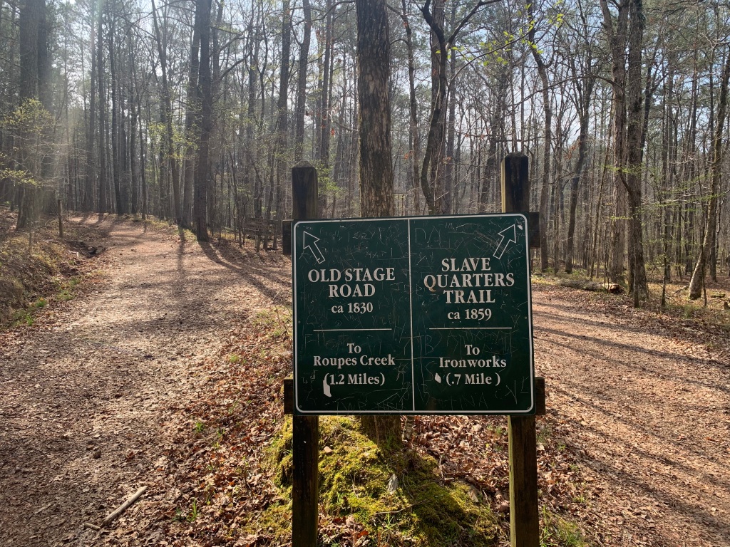
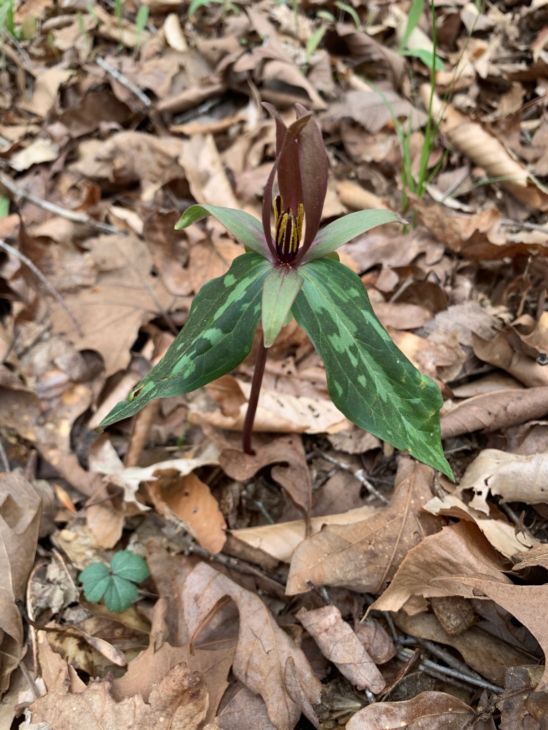
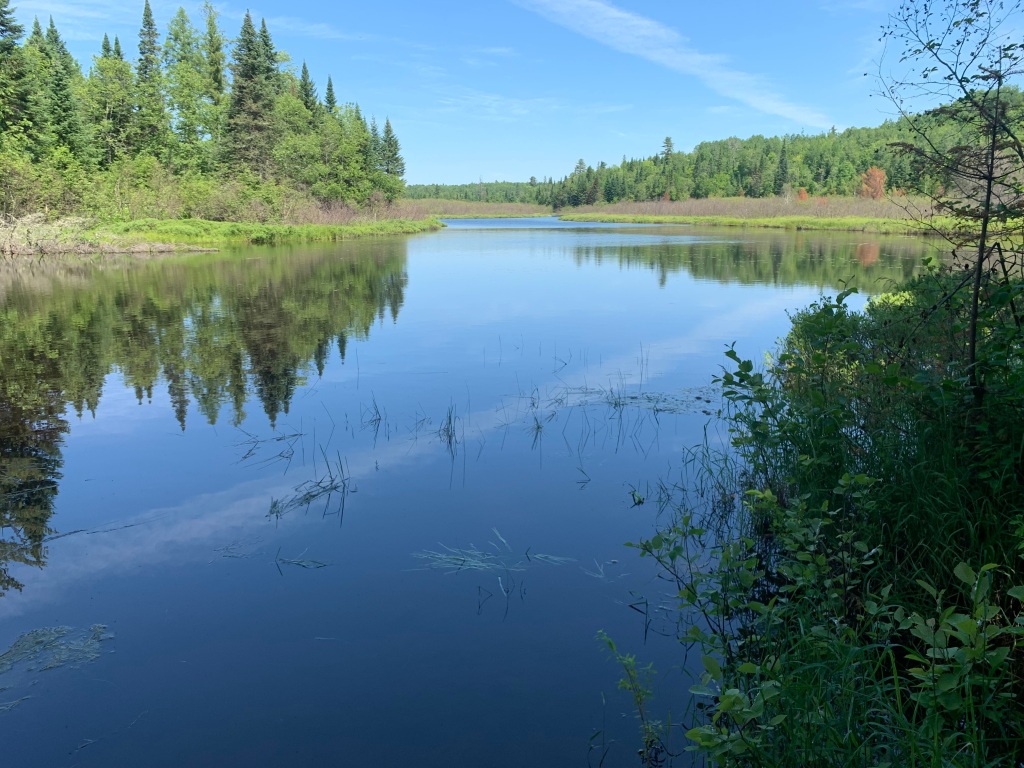
Hikes in the park at times follow an old stagecoach route or the Iron Road where the pig iron was transported 18 miles by eight team mule wagons to the Alabama & Tennessee Rivers Railroad.Spotted trillium (or perhaps the look-alike Little Sweet Betsy) in a wet swampy spot near Roupes Creek. During my week at Tannehill, the woods began to green up, with flowering dogwood, redbud, and native azaleas adding touches of white, lavender, and pink.Violets bloom in an old slave cemetery, brightening the final resting places of furnace workers and their family members, whose names are long forgotten.
Tannehill is also home to the Alabama Iron and Steel Museum, which surpassed all my expectations. For almost two hours, the story of Tannehill came to life for me. Beginning with the huge seams of brown and red iron ore found locally, to colliers camping in huts to make charcoal to large displays of 1800s household and military items made either here or at the Selma Arsenal.
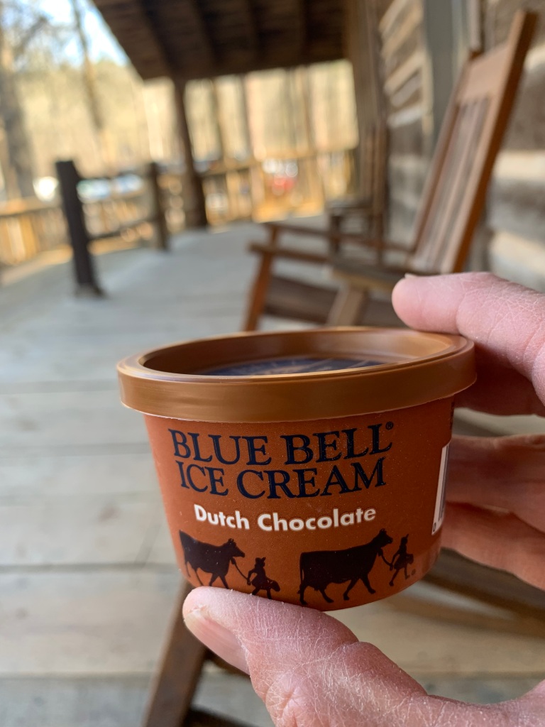
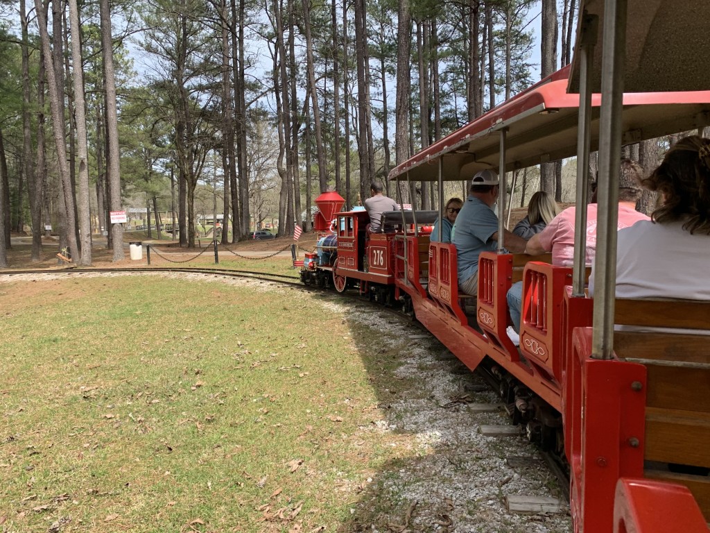
During the Civil War, over fifty Alabama caves were mined for saltpeter (potassium nitrate), the primary ingredient in gunpowder. In the latter years, the job fell to boys too young to fight. This iron pot, made at the Selma Arsenal, is seven feet in diameter and still contains saltpeter residue.Tannehill Ironworks Historical State Park is a mix of the wild, the historical, and the crowded and touristy, but I sure did love a one-dollar Dutch chocolate ice cream after a long hike!r On weekends, this cute train runs from the campground to the pioneer farm, gristmill, and fairgrounds (home to a huge monthly craft show). Just like the ice cream and senior museum admission, a one-way train ride costs just one dollar!Campground 3 offered more privacy and an abundance of gray squirrels exploring the steep hillside behind my campsite. Campgrounds 1 and 2 look more like a crowded RV park.
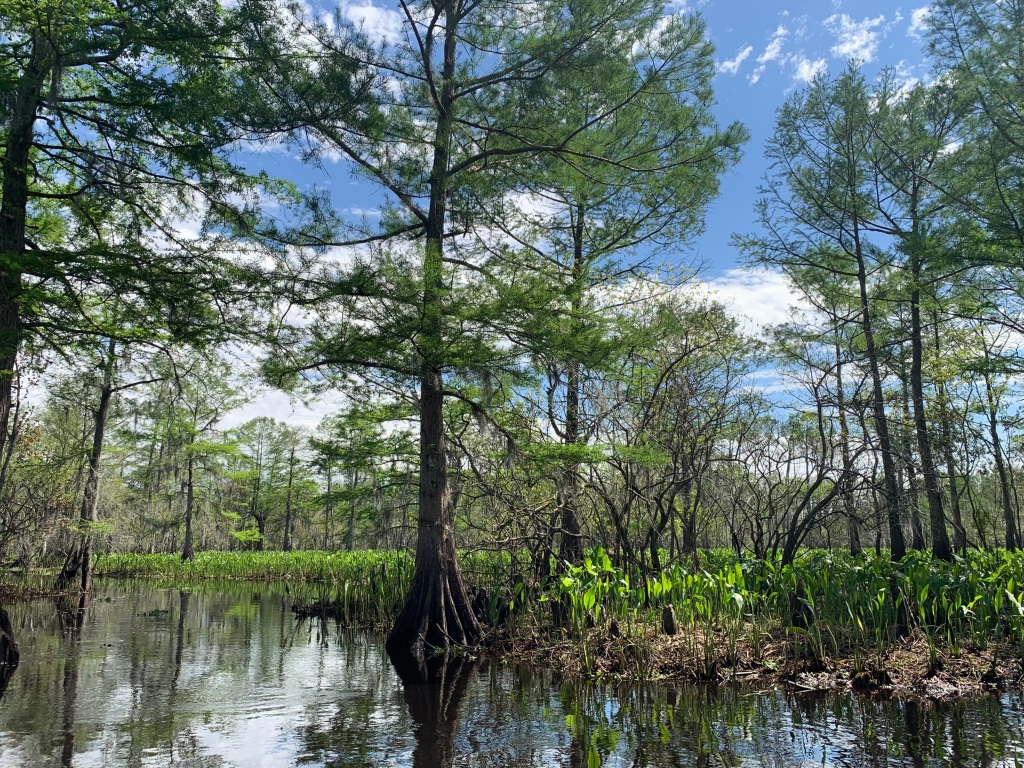
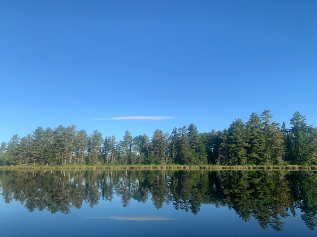
This campground, a wildlife paradise near New Orleans, was the turning around point for my journey.
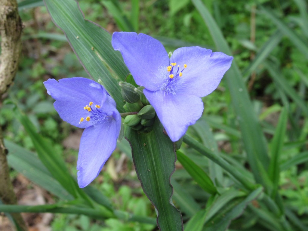
Spiderwort burst into bloom during my 12-day sojourn.
I left Louisiana this morning, to begin my long journey back to Maine. It was sad. For this “62-plus” solo RVer, St. Bernard State Park was the perfect campground (except for the fire ants). With the senior discount, the cost for my water and electric site was just $14 per night. I also lucked out with a long green space that led back to a busy wetland full of wildlife. There were hot showers, an on-site laundry, and it was an easy 18-mile drive to the French Quarter. The main road near the campground goes straight into New Orleans and becomes Rampart St., with parking readily available.
My backyard wildlife list included a red-eared slider, little blue heron, alligator, raccoon, and a pair of yellow-crowned night herons, as well as the almost hourly call of the barred owls.
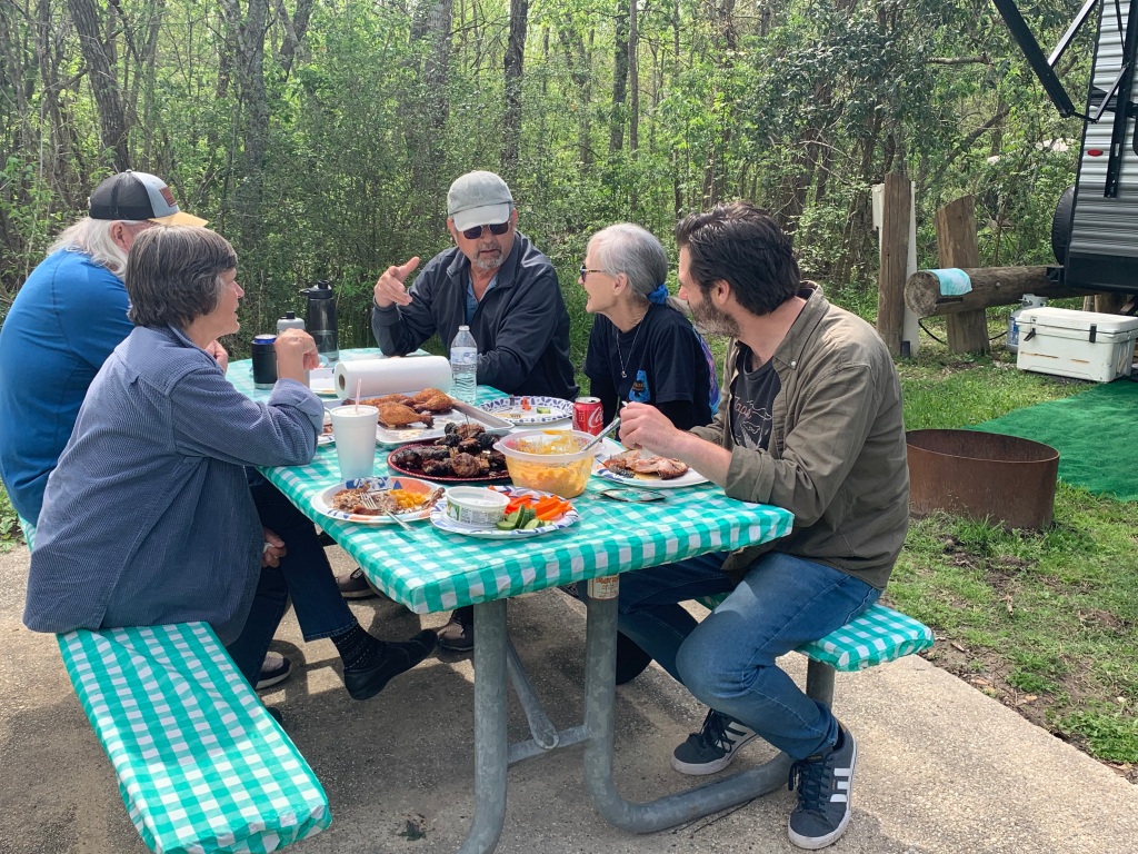
Best of all was time with friends – Sue and Roy, my camping neighbors from Blythe Island in Georgia, and Al and Ingrid, who I met here in the manner I often do, when Al came over to guide my backing up. I am improving, but I don’t want to get so skilled that I no longer make wonderful friends this way!
Al’s smoked chicken quarters and deer wraps with bacon made for a fine picnic!Roy provided much needed moral support for my refrigerator repair. I miraculously discovered the problem (a blown thermal fuse), thanks to advice on the Grand Design owners’ forum. Young alligators in the lagoon beside the state park’s nature trail. There were seven that day, all the same size, in one small area. Later, I would return with Sue to find a huge mother alligator in the same spot, with foot-long babies sunning on her back.Sue, Roy, and I took a four-hour guided kayak tour of the Manchac SwampA non-venomous Mississippi green water snakeRoy and Sue in their canoe, with shrimping boats in the background. We explored the salt marshes of Bayou Bienvenue yesterday. After all the meals and rides and campfires they’ve shared with me, it was fun to show them the abundant birdlife, especially a gorgeous pink roseate spoonbill.
Meeting aome intriguing inhabitants of a tributary of the Conecuh River
After anxiously stalking back and forth in the woods with a repetitive clicking call, this limpkin decided I was alright and strutted and posed for quite a while.
I love stumbling upon an experience purely by chance. In searching for a laundromat, I noticed a sizable body of water north of Andalusia, Alabama. Certainly, it was more substantial than the tiny, mostly spring-fed sinkhole ponds of the nearby Conecuh (cuh-NECK-uh) National Forest where I was camping. After laundry and worship at the Southside Baptist Church, I found the boat launch and a friendly bass fisherman also launching. “That way, it’s all river,” he pointed out, “just watch out for moccasins. There are plenty of them up that way.”
It felt refreshing to be on moving water again. I assumed this was the Conecuh River, which was impounded to create Point A Reservoir, just below. Turns out I was on a tributary of the Conecuh.
I calculated the current at about half a mile an hour, upstream first, just the way I like it. The limpkin called my attention with a strange, unfamiliar, piercing call that no one could miss, then segued to the clicking sound while walking. There were also many turtles out in the on again, off again sun.
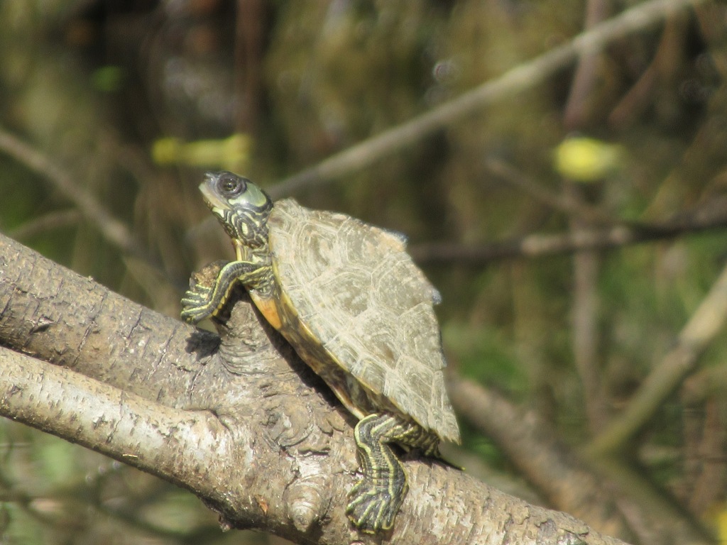
I’m still working on identifying this small map turtle. I saw many of these individuals with two distinctive bumps on their peaked shells, often clinging to steeply slanted branches.The friendly bass fisherman mentioned duck hunting up a little side creek, so I ventured up into this cypress swamp, where I quickly reached a dead end guarded by hungry mosquitoes.
I’ve been using my Garmin Etrex 30 handheld GPS on these paddles to measure distance. This out and back was a little over four miles total, with an average moving speed of 2.0 mph. I’m naturally a slow paddler who spends a lot of time drifting to look at and photograph my surroundings. For those of you keeping track, I now have about thirty-five miles on my new Oru Lake kayak.
One of many flowering trees announcing the start of spring in Alabama. This one was a species of serviceberry or shadbush, perhaps downy serviceberry. This is the map I had to work with, an example of the drawbacks of embracing a spur-of-the-moment adventure. I launched at the upper #1, and the creek that I paddled up is not labeled.
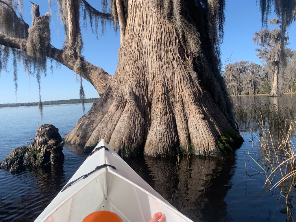
A Civil War battlefield, The Florida National Scenic Trail, and kayaking Ocean Pond among giant cypress
Paddling among giant cypress on Ocean Pond
Before sharing about Florida, I have to tell you that I have now astoundingly joined the ranks of DIY travel trailer fixer-uppers. (Although nothing is fixed yet). Much of this cold and rainy Alabama day has been devoted to trying to figure out why my refrigerator is not working. From the simple checks-breakers, fuses and plugs-I moved on to trying to secure a dealership repair appointment (impossible) or a visit from a mobile RV tech.
The closest tech turned out not to be close anymore as he now lives in Arkansas. But Ron was the best of trail angels, spending hours helping me over the phone. There I was with my multimeter, in the land of circuit boards, colored wires, and hidden fuses. Finally, through a Grand Design owners forum, I discovered a blown thermal fuse that I will soon try to repair. What a learning day!
Site #28 in the Ocean Pond Campground only had a water hookup. However, the generator and solar panel kept me up and running, all but the refrigerator. I sure was looking forward to having cold and frozen food in the campsites ahead, all of which have electricity.
The largest Civil War battle to take place in Florida was fought nearby. The Olustee Battlefield Historic State Park was seven miles from camp. Interpretive panels along a one-mile trail told the story of the evenly matched battle through photographs, primary sources, and a clear narrative. The terrain of open pine woods and palmettos, interspersed with impassable swampy areas, helped me visualize the drama of that tragic day. Just over five thousand soldiers on each side-the Union hoping to cut off food supplies from Florida at the Suwanee River railroad bridge and the Confederates handing them a costly defeat.
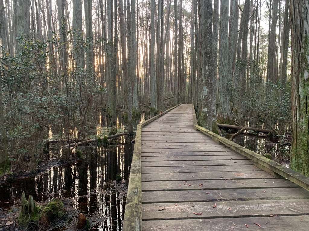
“Grape and canister swept by with hideous music, and shell after shell tore through our ranks and burst amid heaps of our wounded heroes,” remembered a soldier of the 115th New York.Huge crowds attend the re-enactment of the battle every Presidents Day weekend.Boardwalks are becoming a favorite haunt of mine. This one, through a cypress swamp on the Florida National Scenic Trail, enticed me to sit and write and study the verdant plant life.A native green anole (I think) at the edge of the cypress swamp. Anoles, like chameleons, can change color. In Florida, over two-thirds of the lizard species are invasives, including the brown anole, which arrived on cargo ships in the late 1800s. Females of both species look like this one.
Ocean Pond is the roundest body of water I have ever seen. One day, I kayaked around its almost 7-mile shoreline. The shallows near shore are picturesque, with turtles and water lilies among the cypress. I studied one patient great egret who was fishing there, swallowing his catch with bounces of his very long, thin neck. There were patches of pickerel weed, not yet in bloom, and cow lily (spatterdock) just beginning to show its bright yellow, spherical flowers. I love the touches of home to balance out all that is new and unusual.
The border of grass behind me was present almost all the way around the lake and often prevented me from accessing the shallows, except where there were openings. Knowing that there were alligators around and it was a warm day made me cautious to plow through the grass and reeds.
I’ll finish with a shout out to the federal government for their America the Beautiful Lifetime Senior Pass, available to those 62 and older. For a one-time cost of $80, mine has already paid for itself two times over since I purchased it on January 5th. How grateful I am to be experiencing all these natural wonders at such an affordable price!
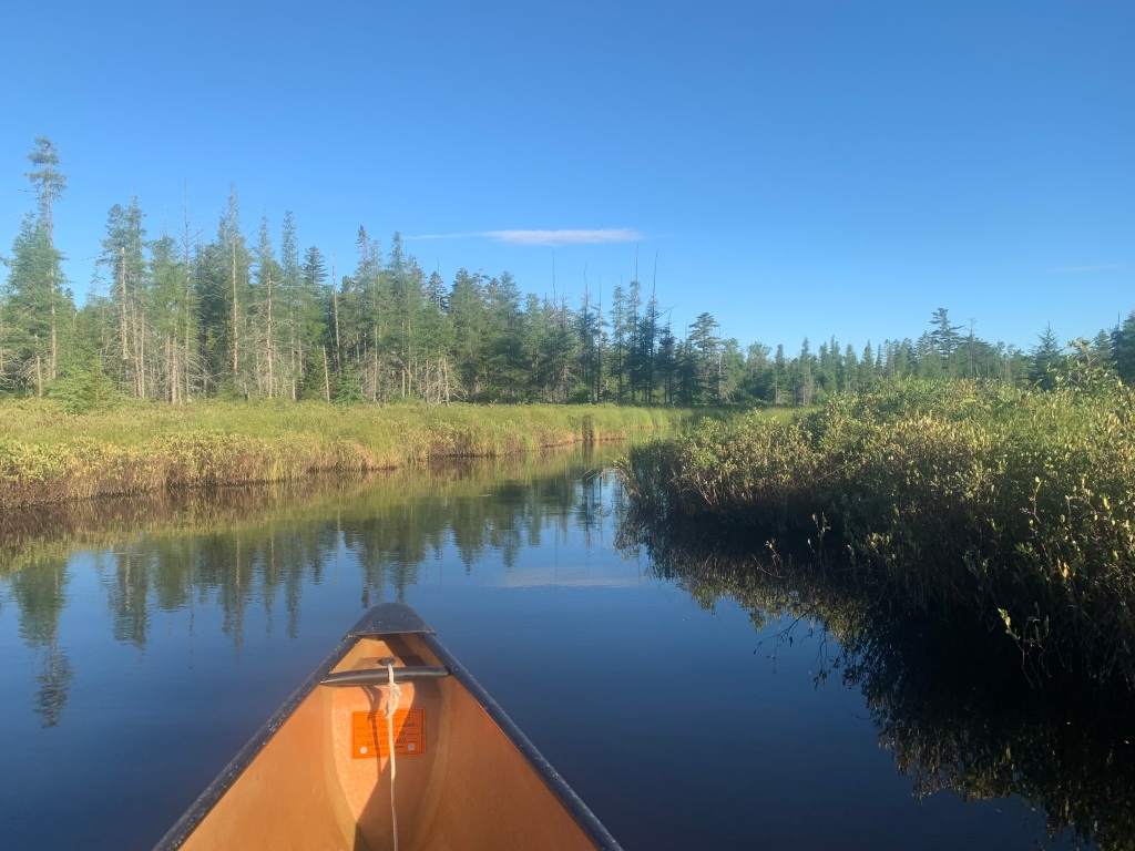
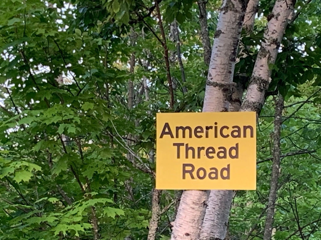
A deer whooshed and crashed away through the woods as I loaded my canoe at Kimball Deadwater in the Seboeis parcel of Katahdin Woods and Waters National Monument. Continuing north two miles on the American Thread Road, I parked at the sign for Twin Ponds, on the left. I would just take a look today and perhaps return with the canoe tomorrow.
A short tenth-mile trail leads to Twin Ponds
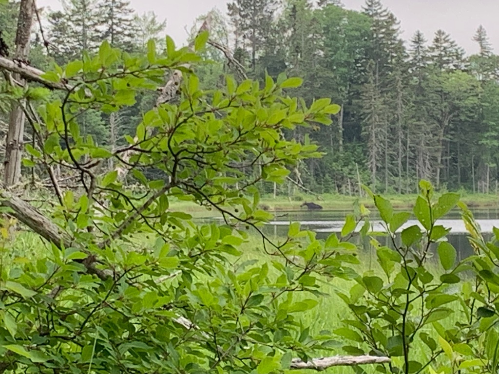
My feet fell silently on the soft path as I cautiously approached the small oval pond. The far shore rose high enough to support a narrow strip of spruce and other conifers. Gradually, most of the perimeter came into view, and there was a cow moose feeding contentedly in the shallows at the south end. I watched her, alert for any sign of a calf or two, for it was that time of year. Sure enough, she soon climbed on shore, and a light brown calf emerged, fuzzy in the morning sun.
Just big enough to see, before the calf appeared. No camera this trip, so photos are from my phone.
I planned to return the next morning to see if I could get through to the even tinier twin pond that lies behind this one. And so I did.
Sunny and still, this is the shoreline that separates the two ponds.
A loon was diving for breakfast, and I watched him swallow more than one silvery minnow. Paddling toward the southwest corner, the connecting stream materialized from what had looked like solid shore. I scrambled out of the boat to lift over a narrow bridge of land and continued on.
The second pond was quite shallow and perhaps a third the size of the first. Along the eastern shore was a colorful bog, its palette rich with reds and greens. Later, checking out the Maine Natural Areas Program categories, I believe it would be classified as a Mossy Bog Mat. Purple pitcher plant (Sarracenia purpurea) flowers poked above the sphagnum mosses, and there were a few scattered trees and clumps of sheep laurel. Walking just far enough for a couple of photos, the spongy ground gave and shifted underfoot.
That afternoon, my friend Chris Gill commented on my last blog post, saying he missed the days when he’d had to identify the plants for me. I said, “You only need to ask,” with a photo of the little orchid below. Chris identified it, of course, then also suggested that next time I look closely in the moss for carnivorous sundews as well. Horned bladderwort, a third carnivorous species with yellow flowers, might also be present, according to MNAP.
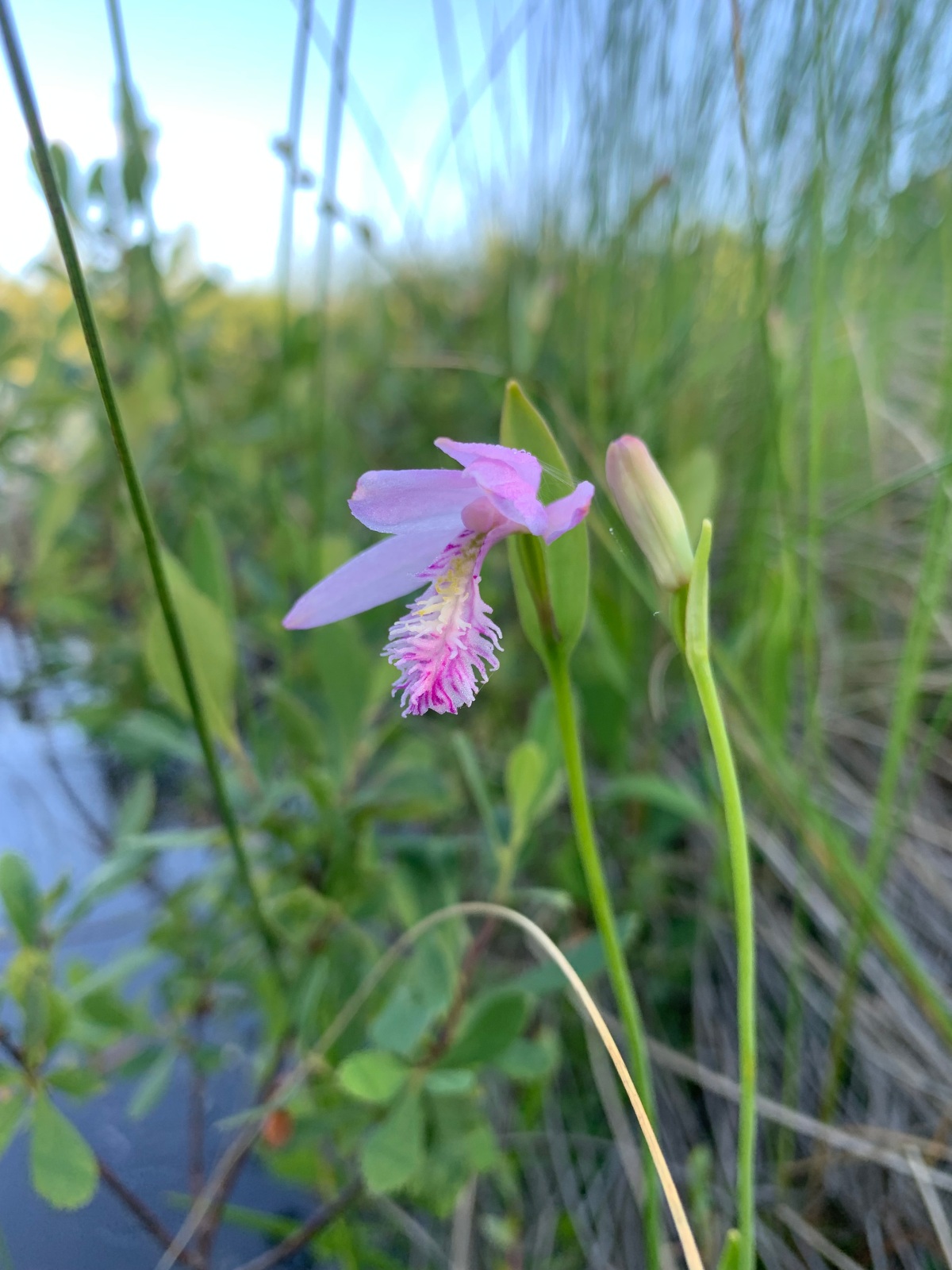
The shaded shore is always the place to back the canoe in and watch for wildlife. It just so happened that the spot I chose offered up a new orchid. “New” meaning that I don’t remember having identified it before, although I well could have. A rose pogonia (Pogonia ophioglossoides), just a single specimen.
This rose pogonia will have a second bloom
The flowers of the carnivorous pitcher plantA pitcher-shaped leaf awaits an unwary insect
From Twin Ponds, the road continued north to the intersection with Grondin Road. Turning right, another three miles brought me back to Route 159. This would conclude my time in the national monument for now.
That evening, my parents and I took a drive to fill our water jugs at a local spring. On a typical whim, we turned into the gravel road to the Shin Brook Falls trail, happily bumping and bouncing along. On the way out, I was perched in the middle of the back seat. Looking ahead to the crest of the slope, there was a bear, smack in the middle of the road. Right size and shape, ebony black, and gone too quickly, before anyone else could see it.
When you rise at four, nature rewards you. Rain was forecast, and I was on the road by five. A porcupine waddled surprisingly quickly along the shoulder of the road, then vanished into the woods. I entered the Seboeis parcel of Katahdin Woods and Waters National Monument on the American Thread Road. Since yesterday’s drive, I’d been pondering that name.
At first, I envisioned the historic site of a mill that manufactured sewing thread. Not so, although I was on the right track. The American Thread Company also produced wooden spools to hold its thread. When the supply of birch was exhausted in one area, a new spool mill would be built elsewhere. The last, in Milo, Maine, was in operation from 1902 to 1975.
Kimball Deadwater soon narrows, winding into an impassable tangle of alder
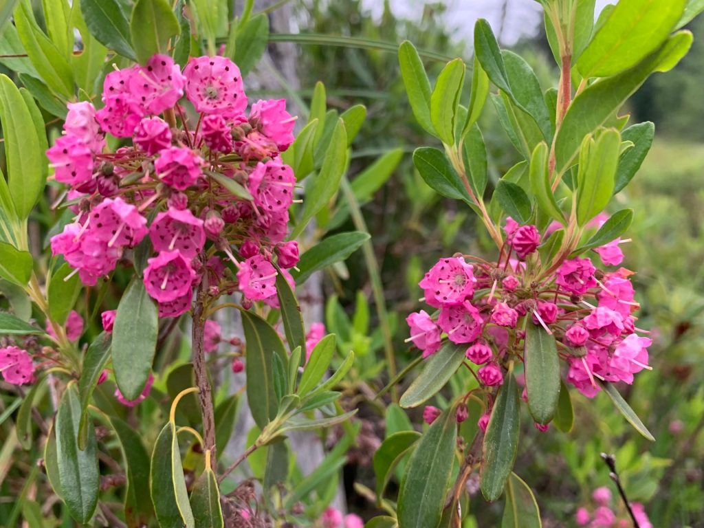
At the short Kimball Deadwater trail, I unloaded my canoe and carried it down to the water. The telltale wake of a cruising beaver cut across the wide water, and I spotted a sleek brown head gliding along. I savored the short paddle, drifting close to photograph sheep laurel and blue flag iris.
Sheep laurel
Blue flag iris
Of course, the true barometer of success would be spotting a moose. I spent an hour quietly waiting. A strong wind had risen ahead of the rain and it washed over me, keeping the mosquitoes at bay. Delicate heads of marsh grass bowed low, and the red-winged blackbirds moved with restless energy, flashes of color bright in the cloudy sky. From near and far came the twang of bullfrogs.
Spatterdock
Before giving up, I paddled the length of the deadwater a second time, 15 minutes for the round trip. It isn’t large. Near a patch of spatterdock, I saw the beaver again, or another one. After I was well gone up the trail came an emphatic tail slap that said, “Good riddance.”
It’s been a long two years since I’ve written a blog post. Amazing!
There is one good explanation. In the spring of 2021, I began writing a monthly column for the Northwoods Sporting Journal. My articles for “View from the River” are varied, covering paddling, wildlife, wilderness places, and even book reviews. The discipline of a deadline has been motivating and the writing itself rewarding. But with summer here, I want to blog, too.
Today, my parents and I explored the national monument parcel that lies south of Shin Pond. Not long after passing the monument boundary on the well-maintained American Thread Road, we had our first view of the mountains.
About a mile in was a sign for the Kimball Deadwater. Down the short trail shone the unmistakable brightness of water. Here was a place where I would like to return one early morning with my canoe. It looked moosey, and perhaps a half-mile long on the map.
Kimball Deadwater
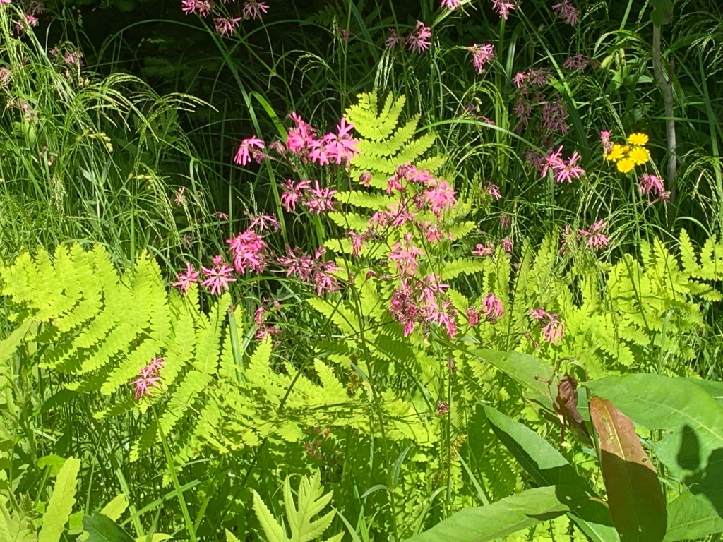
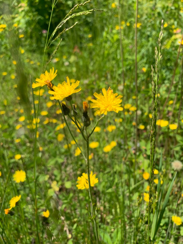
The wildflowers along the roadsides were stunning in their sheer quantity. Our field guide yielded new discoveries: pink ragged-robin and large displays of yellow king devil, which looks much like orange hawkweed.
Ragged-robin
King devil
The large flowers and leaves of cow-parsnip gave us quite a scare. I was sure I’d seen the flower before, but Dad pointed out that it looked remarkably similar to giant hogweed. In the Adirondacks, we’d seen posters warning about this very toxic invasive plant. Its sap causes a dangerous skin reaction and even blindness if it gets in the eyes.
As it turns out, the two are closely related, in the same genus. Giant hogweed can get twice as large as cow parsnip (14 feet tall) and has stems mottled with red, while those of cow-parsnip are solid green. I am going to give cow-parsnip a wide berth as well, after learning that it can also cause a milder irritation.
Cow-parsnip
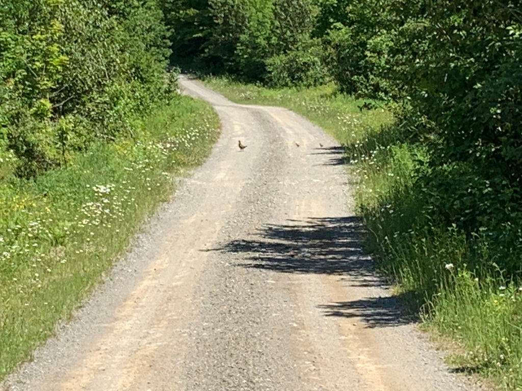
We saw both a spruce grouse and this ruffed grouse with two chicks, rounding out a drive that left us wanting to return to this quiet part of the monument.
How long (twenty-one months) I have waited to say those simple words! For a couple of weeks, someone else will meticulously read and reread the manuscript – moving commas, detecting typos, and double-checking the spelling of Caucomgomoc, Seboeis, and Wassataquoik. Meanwhile, I can do the fun stuff, like finalizing the photos.
Taking off from my house up north, I spent my first day of freedom exploring. Snow still clung to the high peaks. At the greenhouse in Patten, buying cages for the peonies I’ve uncovered in my wild, untamed garden, I asked about the recent freezing temperatures. Local wisdom, it turns out, says frost can be expected until the first full moon of June. For 2020, that will be on June 5th.
The descent to nearby Shin Brook Falls is made possible by an indispensable system of ropes beside the steep trail. Climbing above the main 30-foot drop, the trail follows the tumbling stream past a succession of smaller cascades, equally lovely.
My goals for the day included: (1) finally hiking a portion of the Seboeis River Trail, (2) visiting the Christianson family at Matagamon Wilderness, to see how they were faring amid the cautious reopening, and (3) spotting a moose, of course.
The moose spotting took the longest. Pleasantly weary from hiking and pleasantly full from cheeseburger-eating, I drove up to the Francis D. Dunn Wildlife Management Area. So far, I’d seen moose tracks and moose poop, not to mention bear poop, a ruffed grouse, and a garter snake. The marshy Sawtelle Deadwater that comprises this state WMA has always looked moose-y to me and that afternoon it was. A small bull with fuzzy antlers emerging was accompanied by two cows, all looking shaggy and scruffy. Only one caw was brave enough to continue feeding while I watched from afar (too afar for a photo) through my binoculars.
My first day of liberty had been well rewarded.
Painted trillium on my two-hour Seboeis River Trail hike
Summer has begun at Matagamon Wilderness, where my friends are “bearing” up well. While I was there, I dropped off a fresh stack of books for the busy months ahead.
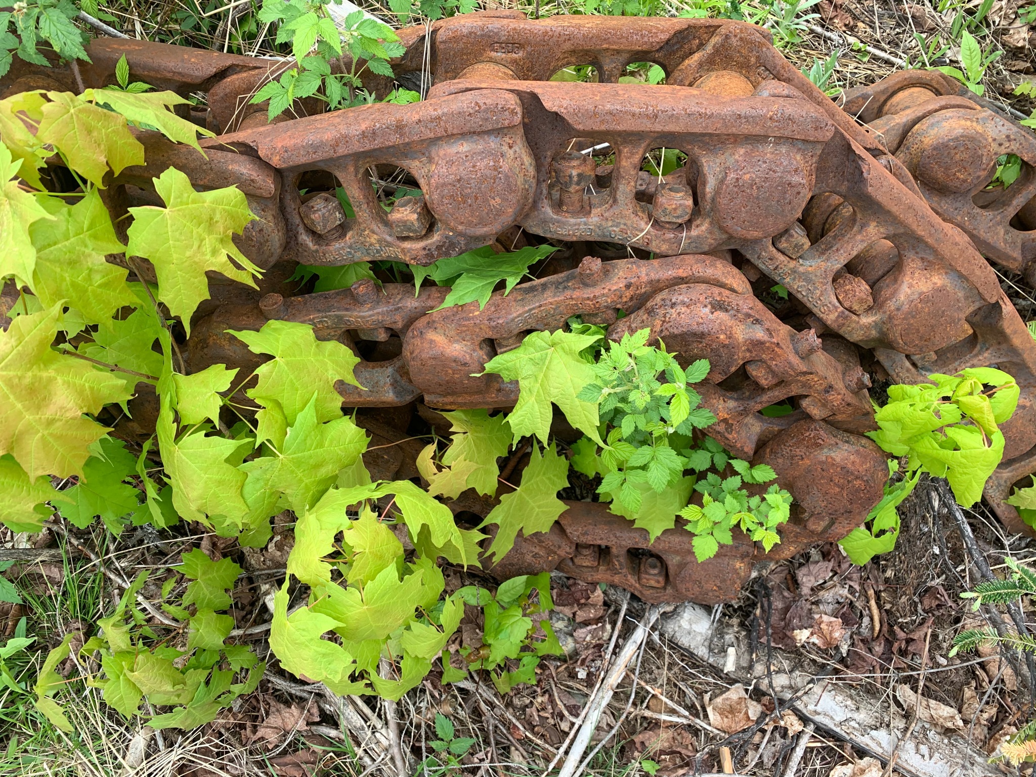
Giant, immensely heavy relic abandoned along an old road
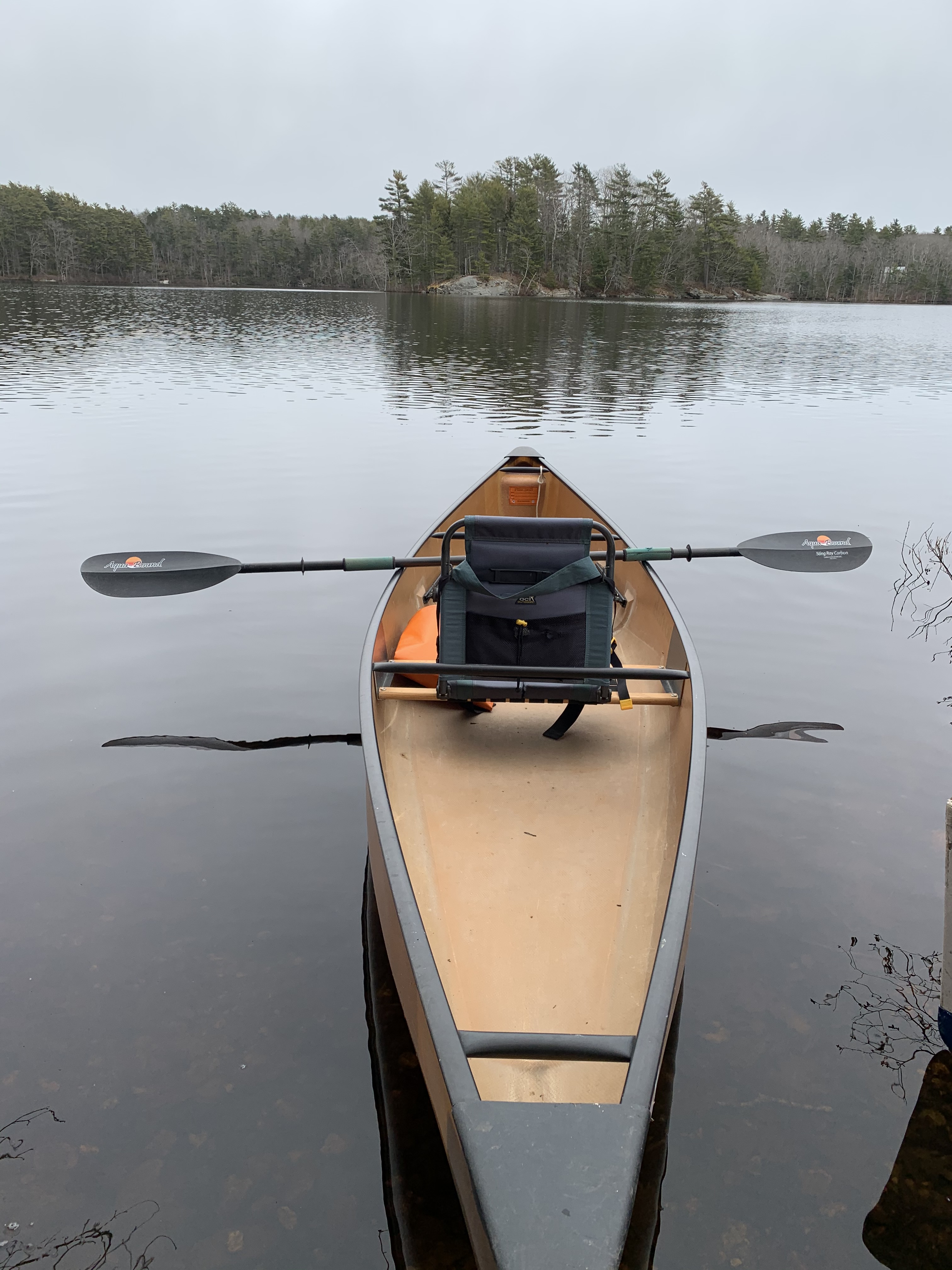
It was raw – the weather, and more – yet beautiful. The shores were thick with ducks and geese, that erupted in whirls of dismay at my approach. My body remembered the rhythm of the paddle. It was the first merging of boat and woman this year.
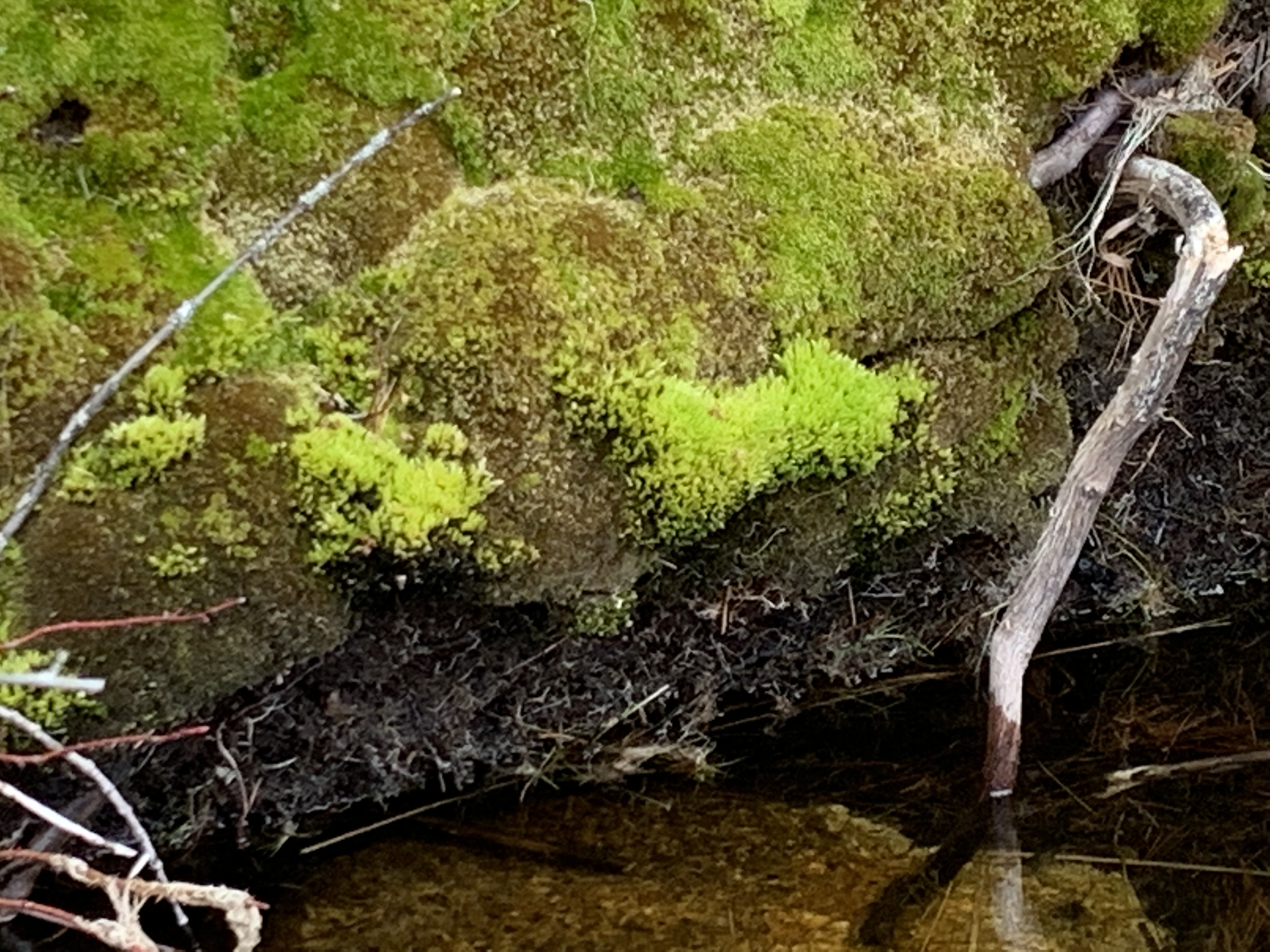
I went into the light wind, for an easier time on the way home. Near the lake’s far end, moss on the bank shone a brilliant green, the most contrast there’d been in the still-wintry landscape. It was enough, in this raw, wild day borrowed from summer. One hour on the water would be my bright moss in the winter landscape of recent days.
Yesterday was not good. To be honest, embracing hope was not working. I couldn’t settle into my writing, and there was not much joy in the busy tasks I thought up to take its place. I soldiered on, though, driving the canoe from its winter resting place down to the lake, stacking firewood, writing to a few old friends. And today is better. Hope is back.
Not long after the moss came the haunting call of a loon. My heart thrilled, as I did not know they had returned to inland waters. A patch of white against the distant shore, though, turned out to a bufflehead, one at first and then two pairs.
When the loon popped up, he was darker than he would be in summer plumage and seemed to be engaged in some sort of acrobatic struggle. My binoculars brought him closer, where I could see he was straining to swallow a large fish, perhaps a bass, far larger than any I’d ever seen a loon tackle. He apparently had a good grip and got it lined up. His neck stretched high and his whole body wiggled. The fish was slowly sliding down, down, down, until even the tail was gone. I watched to see if he could still breathe or float, but with the task over, he looked unfazed. That was very cool.
A chill rain set in as I turned homeward, ready to write by the woodstove once more.
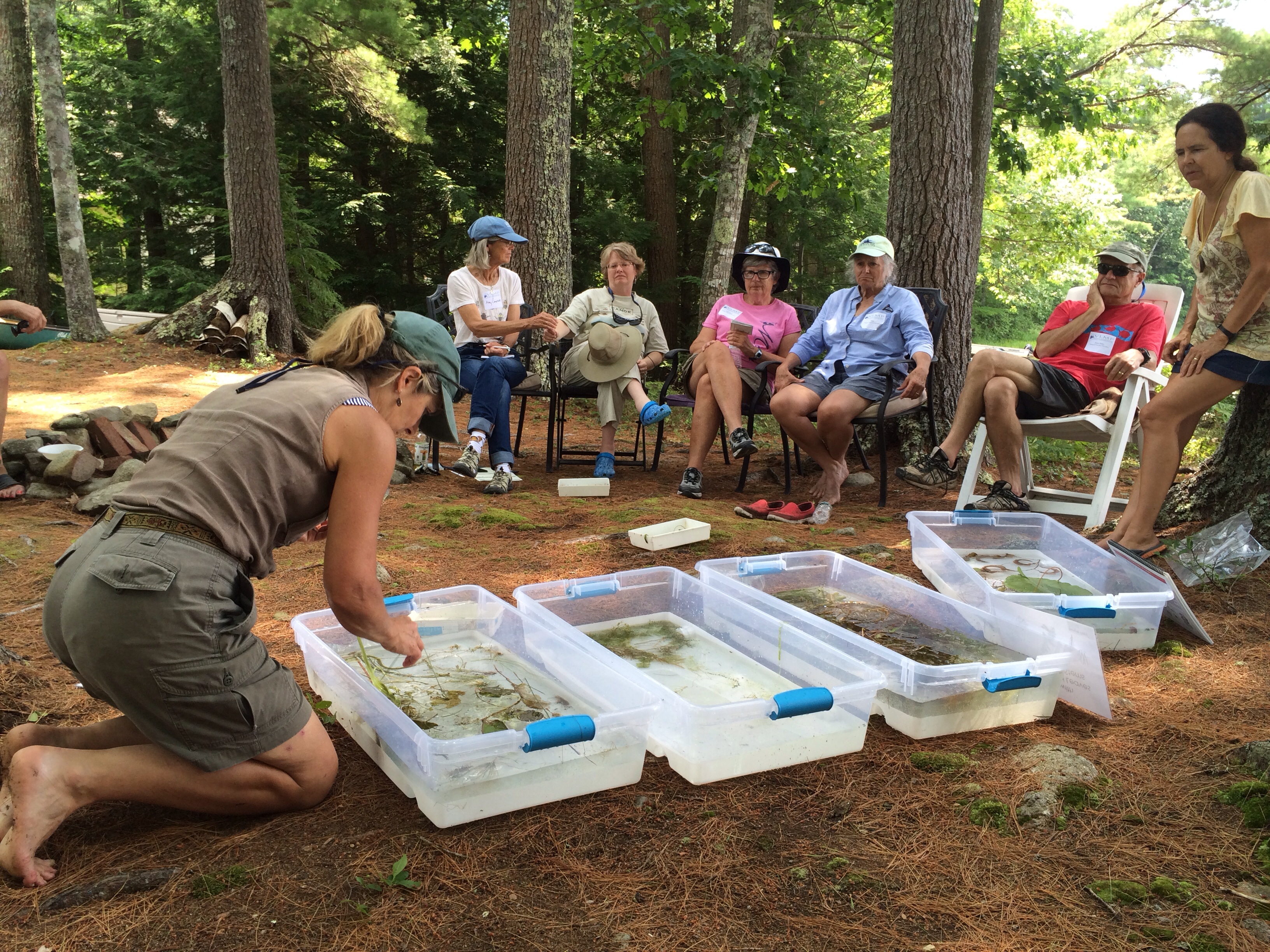
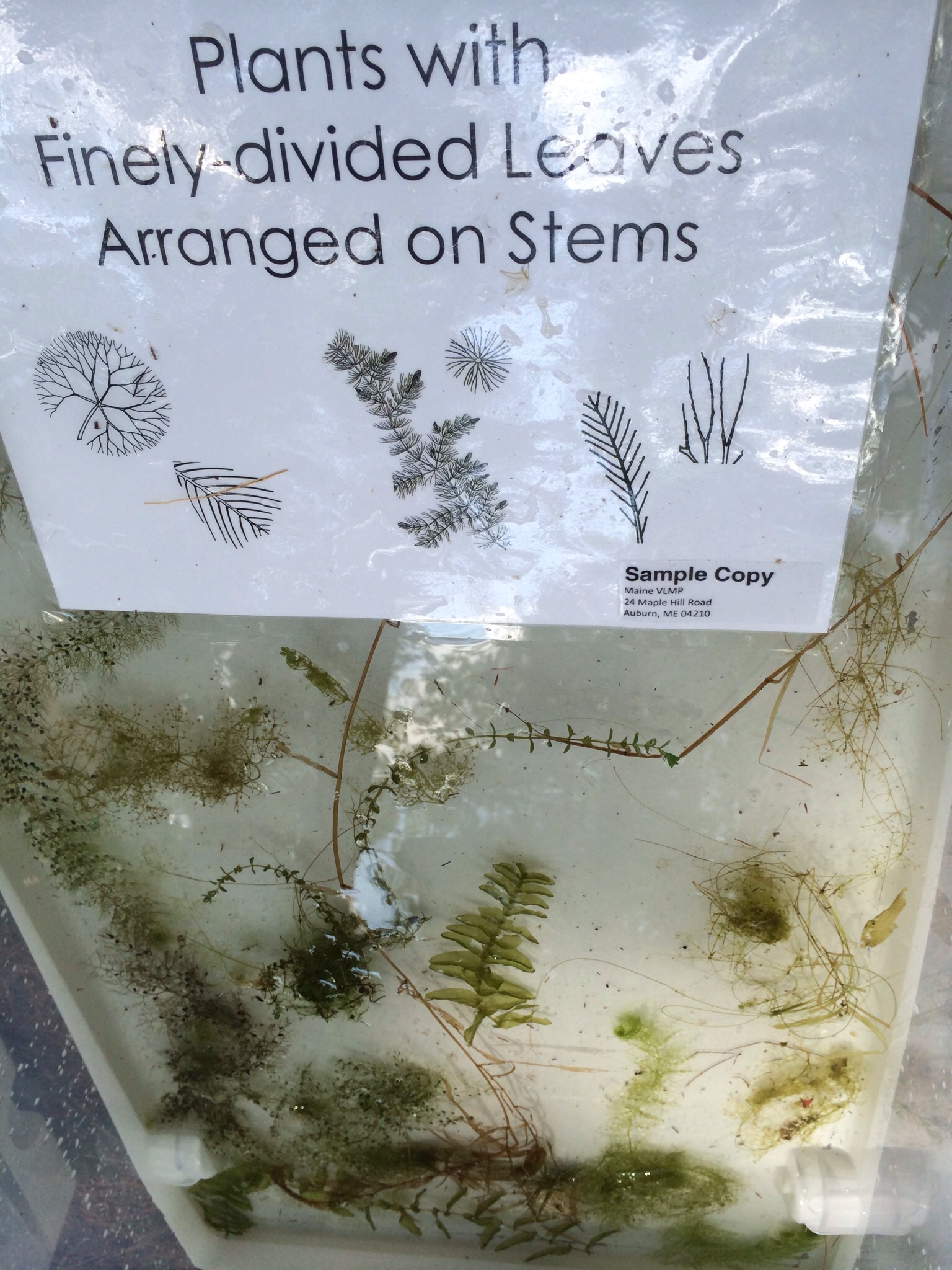
Roberta Hill, from the Maine Volunteer Lake Monitoring Program, helped us sort and identify the aquatic plants we collected from Pemaquid Pond during our Invasive Plant Patrol workshop.
Back in 2009, a man named Dick Butterfield did what I did yesterday. He attended his first workshop with the Maine Volunteer Lake Monitoring Program (VLMP), to start learning to identify dangerous invasive aquatic plants. His thirst for knowledge, combined with concise, effective training, soon saved one of our local lakes.
No doubt armed with his mini waterproof identification key to the 11 most-unwanted suspects, he ventured out on his very first patrol, on nearby Damariscotta Lake. And found hydrilla, which the Maine DEP calls “the most problematic invasive plant in North America.” The lake is huge, with 45 miles of shoreline, but volunteers and experts sprang into action to contain the hydrilla in the tiny cove where Dick had found it. Dick caught it early, which is critically important in the fight against invasives.
Paired up with buddies, we went out into our assigned sectors to collect plant specimens in the littoral zone, the zone of richest diversity along the lake’s shoreline.
Our workshop was information-packed, but my message for you is simple. In Roberta’s words, “The work of citizen scientists [volunteers] on the the front line is the most important piece in this fight.” Training focuses on just those 11 likely culprits, which fall into three main structural categories. That means that some types of plants (like hairy, grass-like stuff) you see can just be ignored. To demonstrate how easy screening samples can be, VLMP recently set up a table at L.L. Bean and taught willing shoppers how to use the key. Their average time to key out a sample was just two minutes.
The sorting pan for one of the three broad categories that the eleven-most-unwanted invasive plants fall into. Although we were just learning, and made some mistakes, visible in the photo are some innocuous native milfoils and bladderworts that we collected on our plant patrol.
I was invited to yesterday’s workshop by the Pemaquid Watershed Association, which I’ve belonged to for many years. One of my resolutions for 2017 was to become a more active PWA volunteer. I’ve been writing some press releases and plan to volunteer for plant patrols on McCurdy Pond, where I often keep my canoe. If you’re interested in learning more, visit the Maine Volunteer Lake Monitoring Program or take a peek at the Key to the Eleven Most Unwanted Invasive Aquatic Plants.