
I want to begin with a note that my posts will not always appear in exact chronological order. In order to be a little more secure, I will be posting some details about my solo RV journey (like exact camping locations) after the fact. In the meantime, here’s a peek at yesterday’s adventure.
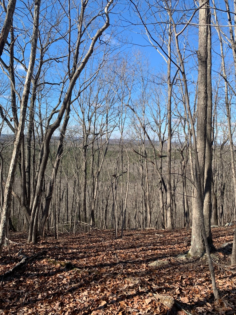
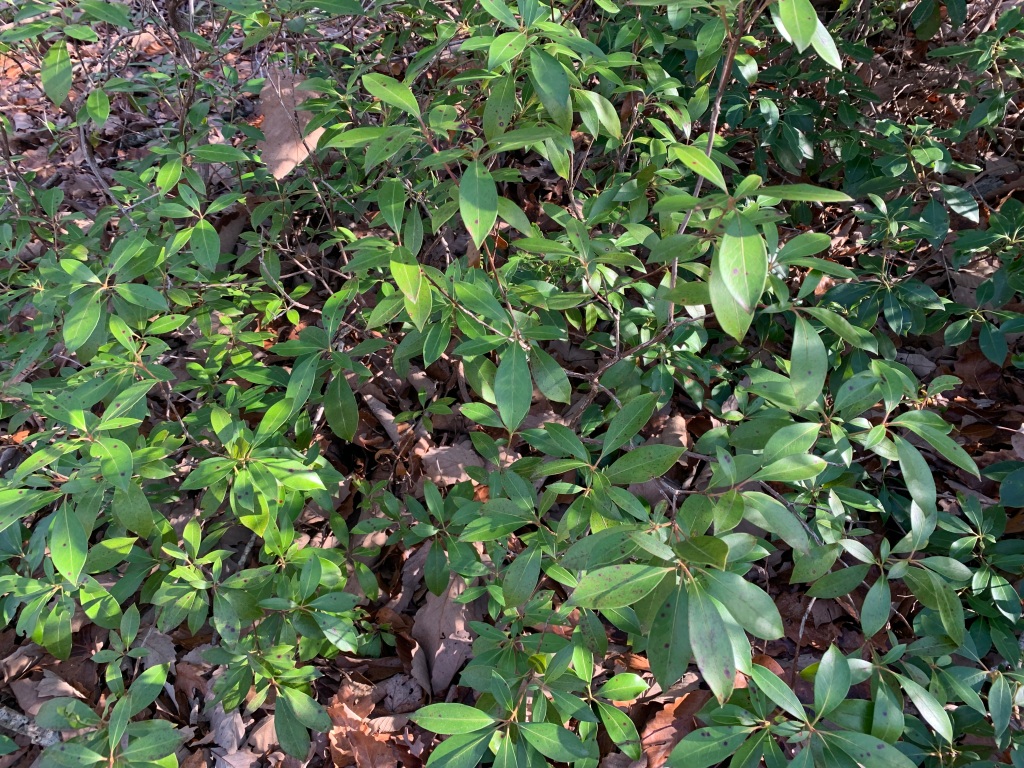
The 40-mile Uwharrie National Recreational Trail can be completed as a thru-hike or enjoyed in short sections. I began at the Jumping Off Rock trailhead, hiking south for the short, but rather steep, 500-foot ascent to the shoulder of Dark Mountain. Highlights were the beautiful open hardwood forest and patches of mountain laurel, which I could picture in its spring delicate, pink-flowered glory. Even in January, it was enlivening to see the shiny green.
After the initial climb, the rest of the trail (4 miles roundtrip) was less rocky and smooth, with only gentle ups and downs. Wooden signs marked each mile, and surprisingly, there were audio stops where you could scan a QR code to listen to snippets of area history and ecology. The name Dark Mountain derives from tales of the killing of Army deserters here and an outlaw cave that was the hiding place for a murderer of one of those pesky revenuers.
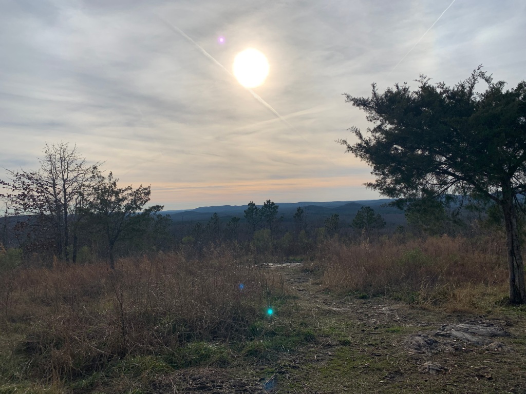
Moving on to the nearby Joe Moffitt Trailhead, named for the Boy Scout leader who created the trail, I could choose between two hikes. To the north, King Mountain, the highest peak on the trail at 1,020 feet, was a 1.1-mile climb. To the south, Little Long Mountain was 0.8 miles away and provided the most open mountaintop vistas. I went south, hiking back toward Dark Mountain.
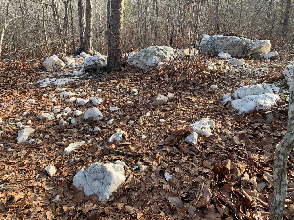
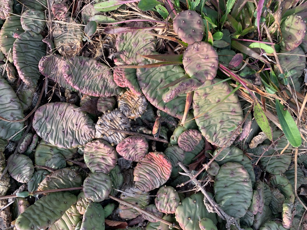
At the Little Long Mountain summit, another audio tour stop explained that I was standing in a Piedmont glade. Characterized by thin layers of soil over rock, this ecological community features unique plant species like native prickly pear cactus (Opuntia humifusa), which I found in abundance. There is a lean-to here, as well as a spring providing a water source on the way up. Descending, my first white-tailed deer of the Uwharrie bounded away down the hillside.

I’m looking forward to enjoying your trip.
LikeLiked by 1 person
Yay, delighted that you are following along! I’ve got so much to write about already.
LikeLike
So interesting, Laurie, to have audio informational stops along the trails.
LikeLiked by 1 person
Such an interesting hike…green ground cover in January, “pesky revenuers,” and QR codes for informational signage! And no crowds!! Thank you for bringing us along on this walk on Uwharrie National Recreational Trail.
LikeLiked by 1 person
The integration of technology in our national forests has surprised me. To make my next reservation, I needed a new phone app and another to download the official Forest Service maps. Once downloaded, they will be available offline. And, yes, I am thrilled at all the touches of green in the January woods!
LikeLike